Abiquiu News
  • Home
    • News 05/16/2025
    • News 05/09/2025
    • News 05/02/2025
    • News 04/25/2025
    • News 04/18/2025
    • News 04/11/2025
    • News 04/04/2025
    • News 03/28/2025
    • News 03/21/2025
    • News 03/14/2025
    • News 03/07/2025
    • News 02/28/2025
    • News 02/21/2025
    • News 02/14/2025
    • News 02/07/2025
    • Criteria for Submissions
  • News and Features
  • Dining
  • Lodging
  • Arts
  • Bloom Blog
  • Activities / Classes
    • Birding
  • Tech Tips
  • Classifieds
  • Real Estate
  • Real Estate by Owner
  • Support

The Ojitos Trail

11/11/2022

1 Comment

 
Picture
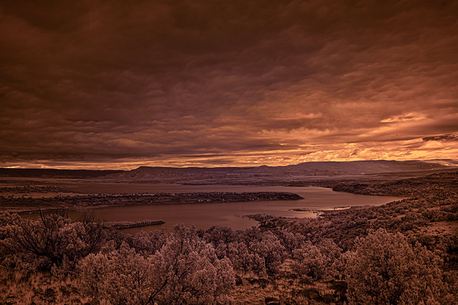
Greg Lewandowski
See Greg's Photography online

​​The Ojitos trail can be found 8 miles down 151 off of 84. This is the monastery road. Be cautious on 151 there are very sharp switch backs and plenty of opportunity to slide off the road. Just at 8 miles on the left is a small parking are with some forestry boards up with info about the area. Skull bridge is also right there.
 
On the right is the tailhead (TH). There is a pole marker near the TH. It’s a narrow trail and starts off uphill over rocky terrain. This is part of the Continental Divide Trail. It is well traveled and well maintained. There are no forks to worry about. Watch for switchbacks. As you hike up you will begin to see over your shoulder excellent views of the Chama River Valley, part of the Chama River Wilderness. I stopped frequently to take in these majestic views. The trail goes through a few clearings, some narrow uphill spots and always rocky.
 
After about 2 miles you will go through a forested area. Quite lovely with the light through the trees as it hits the trail. After 4 miles you will have reached the top of the ridge where the trail flattens out. You will have climbed 1600 feet of elevation in 4 miles. On the top are more majestic views of the valley. I hiked another 2 miles before turning back. I found the top of the ridge to be a great spot for a backpacking trip. The morning and evening light on the red rock walls and the river would make for some great photos.
 
I would rate this to be a moderately difficult hike. It took me about 7 hours and I covered close to 12 miles.
 
Prep
Hiking poles
Sturdy hiking boots
Although this is a day hike it is still a wilderness hike and I always carry appropriate equipment A search and rescue device, I use Garmin inReach.
A GPS, I use the Gaia app on my iPhone. It will track me back if I get off the trail and I save the trail on my unit.
I took 2L of water although I didn’t use it all I always pack a head lamp.
 
Be safe and enjoy our wilderness area.
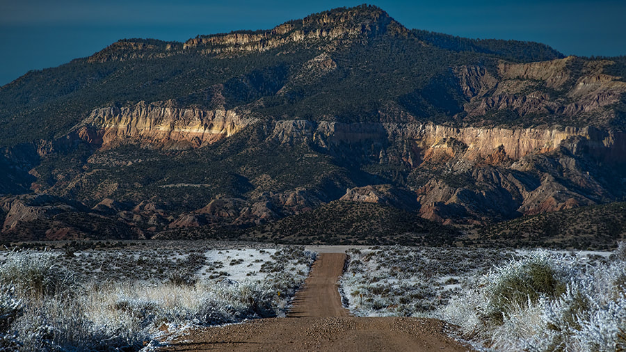
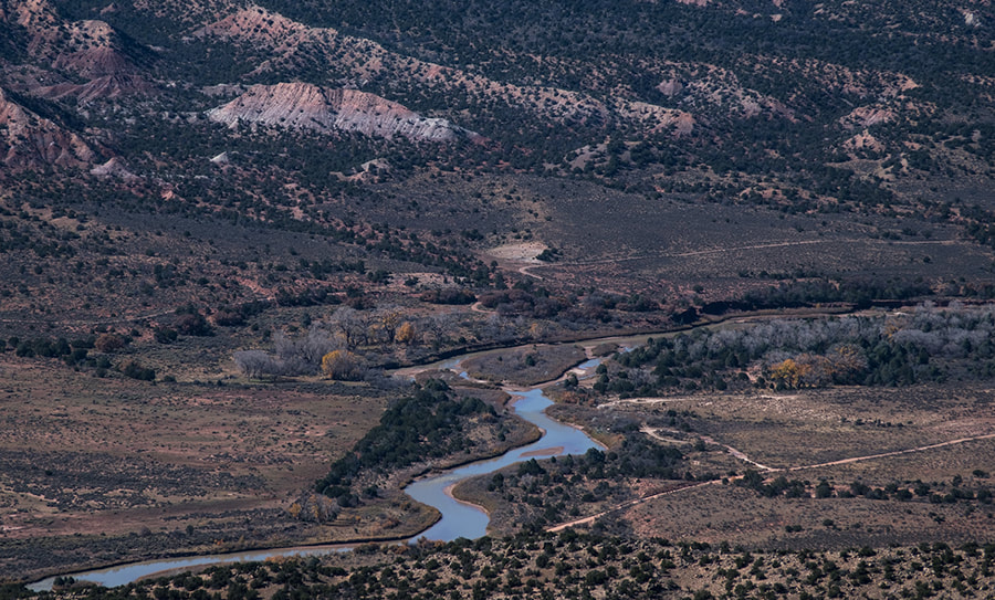
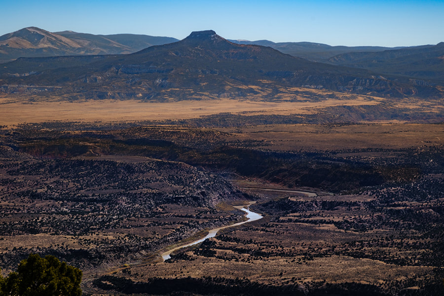
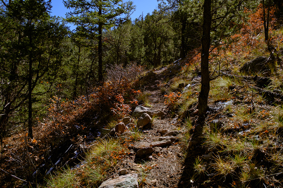
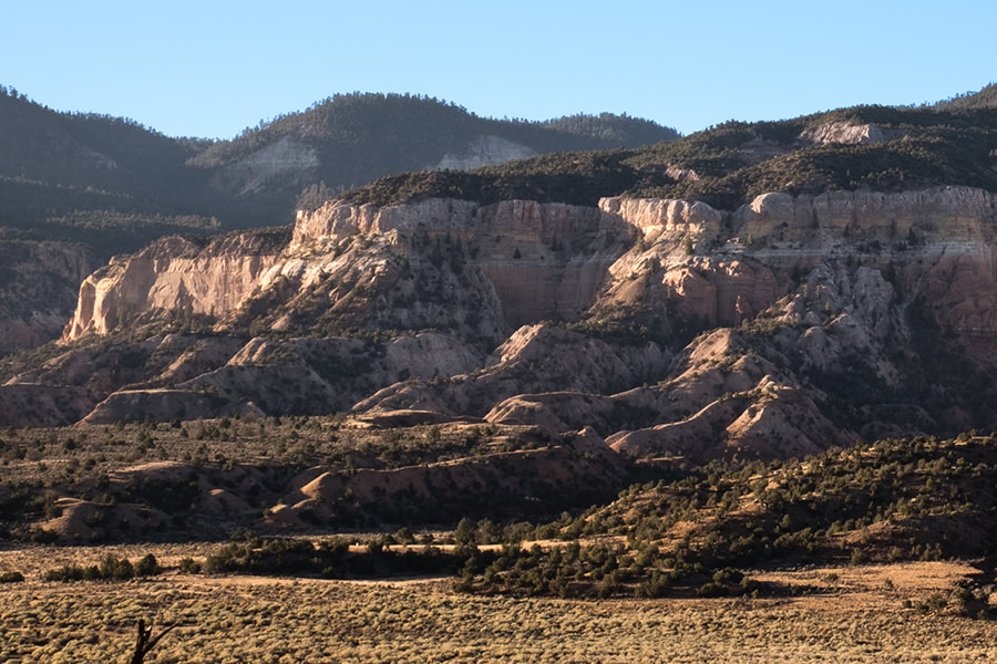
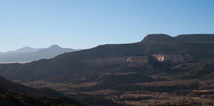
Picture
Picture
Picture
Picture
Picture
Picture
1 Comment
Wanda Roach
11/11/2022 09:22:38 am

Your photos are inspiring.....wish to back on the trails!

Reply

Your comment will be posted after it is approved.


Leave a Reply.

    Submit your ideas for local feature articles
    Profiles
    Gardening
    Recipes
    Observations
    Birding
    ​Essays
    ​Hiking

    Authors

    You!
    Regular contributors
    Sara Wright Observations
    Brian Bondy
    Hilda Joy
    Greg Lewandowski
    ​Zach Hively
    Jessica Rath
    ​AlwayzReal

    Archives

    May 2025
    April 2025
    March 2025
    February 2025
    January 2025
    December 2024
    November 2024
    October 2024
    September 2024
    August 2024
    July 2024
    June 2024
    May 2024
    April 2024
    March 2024
    February 2024
    January 2024
    December 2023
    November 2023
    October 2023
    September 2023
    August 2023
    July 2023
    June 2023
    May 2023
    April 2023
    March 2023
    February 2023
    January 2023
    December 2022
    November 2022
    October 2022
    September 2022
    August 2022
    July 2022
    June 2022
    September 2021
    August 2021
    June 2021
    May 2021
    April 2021
    March 2021
    February 2021
    January 2021
    December 2020
    November 2020
    October 2020
    September 2020
    August 2020
    July 2020
    June 2020
    May 2020
    April 2020
    March 2020
    February 2020
    January 2020
    December 2019
    November 2019
    October 2019
    September 2019
    August 2019
    July 2019
    June 2019
    May 2019
    April 2019
    March 2019
    February 2019
    January 2019
    December 2018
    November 2018
    October 2018
    September 2018
    August 2018
    July 2018
    June 2018

    Categories

    All
    AlwayzReak
    AlwayzReal
    Brian
    Felicia Fredd
    Fools Gold
    Hikes
    History
    Jessica Rath
    Karima Alavi
    Observations
    Profiles
    Recipes
    Reviews
    Rocks And Fossils
    Sara Wright
    Tina Trout
    Zach Hively

    RSS Feed

affiliate_link