|
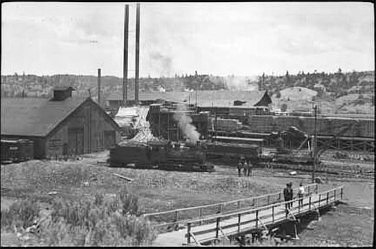
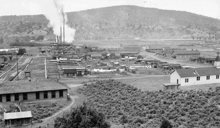
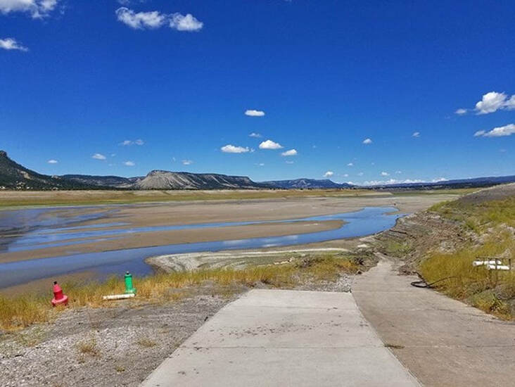
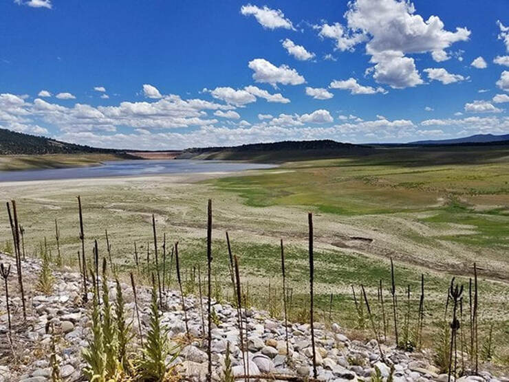
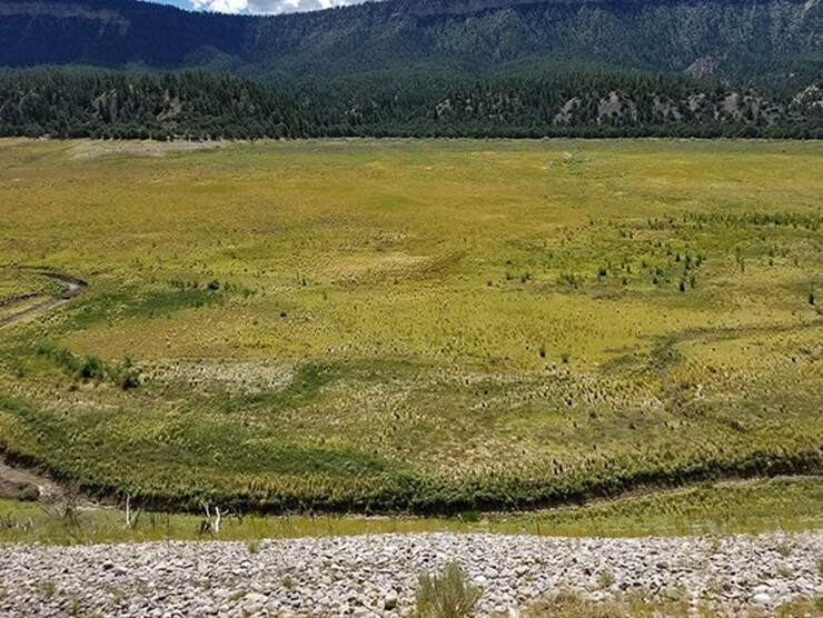
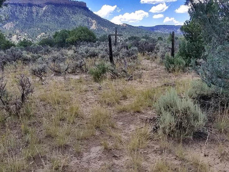
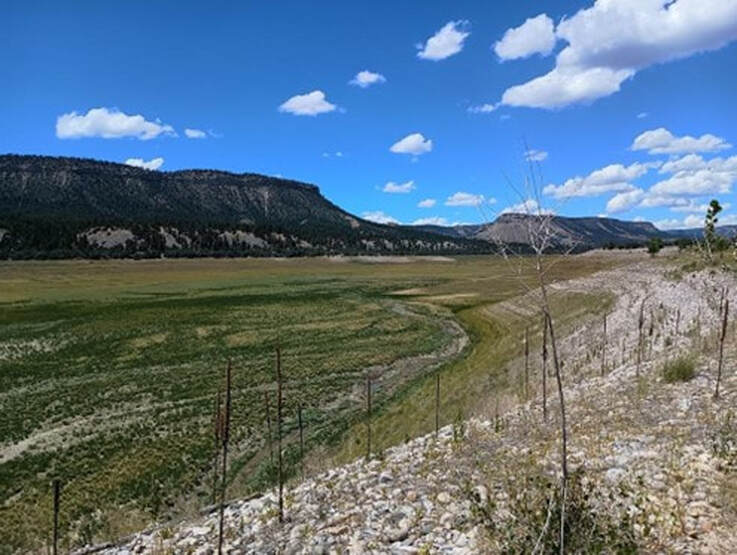
By Jessica Rath Once Rio Arriba’s busiest hub, now at the bottom of a lake. Ever since I learned that Abiquiú Lake’s water level was so high because El Vado Lake was being drained, I was curious – might there be some visible ruins? Some remnants of human habitation? You may remember that I had spoken with John Mueller, Operations Manager at the Abiquiu Dam, who had explained that in addition to the snow melt our lake received all the water from El Vado Lake because the dam was in need of repair. He also told me that the name of the lake came from a town that used to be there. WHAT? A town? Under water? I decided to drive up there and look for old ruins. And research the town’s history. Surprisingly, it wasn’t easy to find any records and/or photos of El Vado. Maybe this is because the town lasted for little more than 25 years. Two booming industries complemented each other in northern New Mexico from the end of the 19th century into the early 20th century: the logging business and an ever-expanding railroad network. The trains needed lumber for railroad ties and bridges; the coal mines that provided fuel for the trains needed props; and in exchange, the railroads transported tree logs to and from the lumber mills. People could find steady work, and enterprising capitalists could make a fortune. By 1910 El Vado had become the largest town in Rio Arriba County with over 1,000 residents; a number of sawmills had sprung up, and the Denver and Rio Grande Railroad stopped in El Vado to ship timber to many locations (I learned this from an article in the Rio Grande Sun, published just about ten years ago). The McPhee & McGinnity Lumber Company of Colorado operated a large lumber mill in El Vado which in 1917 was damaged by fire; a notice in the Morning Journal of Durango/Colorado reported that El Vado had been destroyed in a forest fire and that McPhee & McGinnity had lost their lumber mill and other buildings. The next day the paper corrected its news and stated that only a lumber kiln had been destroyed by fire, but the town and the lumber mill were unharmed. Clearly, the value of the McPhee & McGinnity company was of utmost importance. The indiscriminate logging which also included old growth Ponderosa Pines 150 feet high and four feet in diameter soon decimated the forests that had covered the whole area around El Vado. By the mid 1920s almost all the trees had been cut down and the logging business moved to a different location. When construction for the El Vado Dam began in 1933, fewer than 100 people still lived in the area, and by the time the dam was completed in 1935 the town was deserted. Which means that water has covered all the buildings, houses, railroad tracks, roads, bridges – whatever was there – for nearly ninety years. Would anything be visible, given that most of what we can see in the photographs above was made out of wood and possibly some adobe, neither of which would last very long, being submerged in water all this time? Although I couldn’t even establish whether El Vado Lake had been drained 100% or whether it was still half-full, in which case one wouldn’t be able to see anything anyway, I was too curious and had to find out. I motivated my friend Peter, who also lives in Coyote, to accompany me for the long ride and possible adventure, and we set off early on a Thursday morning. We drove north on US 84 towards Tierra Amarilla, and then we turned left on NM 112 which took us to the El Vado Dam and to the El Vado Lake State Park. We reached a boat ramp which was closed for obvious reasons; we could see the Rio Chama and established that the lake had indeed been emptied. But how to get to possible ruins? Luckily, the State Park Ranger Station was nearby, and we decided to stop there for some directions. They were closed, but a friendly ranger came out anyway to help us. Without her, we would never have found out where to go! The thing was to reach the peninsula (which we didn’t know anything about), and to do that, we had to drive back all the way to US 84, go a bit further north, and then turn at NM 95 to go to Heron Lake, pass the Stone House Lodge, and then turn left at the Peninsula Drive. There’s a peninsula – we had no idea. It goes about two miles straight south and from the southern tip one can see the dam. The Chama flows to the east of the peninsula, and the town of El Vado was probably on the west side. “It’s steep to go down”, the ranger had warned us, and she was right. It was too steep for me, I was only wearing sneakers and it was too hot. Peter did make it down after we had driven back up for about one mile, but he checked out the side near the Chama, and he found nothing – that’s what the lady had told us to do, but I think she made a mistake. We explored the other side, the area west of the peninsula, and it looks more likely that that’s where the town of El Vado was situated. If you look at the first image at the top, the one with the lumber mill, you notice a little bridge in the foreground. In the image above, you see a small creek, a tributary to the Chama – that could be what the little wooden foot bridge spans. The photograph was taken from a position not much higher than the front of the bridge and with a wide-angle lens; that’s why figures and items in the distance look further away than they probably were. The second image must have been taken from the opposite direction, looking towards the peninsula. One can see the same smokestacks, and possibly the smoke from a locomotive. We did find the old cemetery which of course never was under water, that’s why the wooden cross and the fence posts etc. are still there. I don’t know why I thought we could find old ruins, when wood and adobe clearly wouldn’t last long being submerged for nearly 90 years. To find the metal remnants which must still be there, railroad ties, plates, and other rusty left-overs, one has to hike down the steep slope – wear adequate shoes, possibly bring a hiking pole, and plenty of water. And binoculars would help, too. We’re planning to do this again, soon. The beauty of the area made the long trip worth it anyways, even without anything resembling Stonehenge or the Colosseum in Rome. If you have some other ideas about the location of the town – I know I’m merely speculating – please leave a comment!
18 Comments
Linda Marie DeVlieg
8/11/2023 08:41:10 am
Yes, I have a lovely long article about the building of the dam in El Vado, lots of archeology information. Where shall I send it?
Reply
Jessica Rath
8/11/2023 06:40:03 pm
Thank you, Linda Marie -- Carol forwarded the clips to me -- very interesting! Four years with a post office... another sign of the ephemeral state of the town...
Reply
8/11/2023 11:54:10 am
Very interesting article. A metal detector would come in handy. You can imagine the Ponderosa Pines standing in the meadow. Thank you!
Reply
Jessica Rath
8/11/2023 06:42:04 pm
Thanks, Christopher -- yes, a metal detector would discover all the railroad leftovers. And indeed, there were trees EVERYWHERE.
Reply
Monique
8/19/2023 04:27:37 pm
The use metal detector’s in any state park is illegal. Also removing any artifacts is illegal. Please respect the old mill town of El Vado.
Reply
Jessica Rath
8/19/2023 06:14:03 pm
Thank you for informing our readers about the metal detectors, Monique -- I had no idea they are illegal in state parks. Artifacts -- I think people know to leave them where they are, but thanks for the reminder.
Anita Massari
8/14/2023 07:54:55 pm
Fascinating!
Reply
Jessica Rath
8/14/2023 11:19:32 pm
Thank you, Anita!
Reply
Frances Chavez
8/14/2023 09:34:50 pm
My grandfather Carlos Archuleta and his 7 sisters were born in El Vado
Reply
Jessica Rath
8/14/2023 11:22:34 pm
Oh wow -- that's amazing! Did he have any stories to tell? How long did they live there? I'd love to hear more!
Reply
Frank
8/19/2023 08:49:11 am
Nice article. The town was next to the chama river on east side of peninsula not on the west. Your photo from the boat ramp is where the town was. Foundations are in that photo. Need more pics or info send me an email..
Reply
Jessica Rath
8/19/2023 02:00:50 pm
Thank you, Frank, for letting me know that I got it all wrong... So the town was near the tip of the peninsula, but on the Chama side? How does the top photo fit in -- the one with the train? Where would the Chama be? I'll try to get your email address from Carol. Absolutely would love to learn more!
Reply
Alice Gomez
11/26/2023 11:30:36 am
I was looking at that peninsula with google maps, thinking I had found ancestral pueblo ruins, but after reading your article, I realized that what I was seeing is the outline of the old town of El Vado. It's on the east side of the peninsula.
Reply
Jessica
11/29/2023 07:00:17 pm
Yes Alice, it seems the town was indeed on the East side of the peninsula, where the Chana flows. Thanks for the info about the name -- "the ford" -- it makes sense that people could wade through the river there, it is indeed wide and shallow. One can see this right now, because the lake is empty..
Reply
Franklin C Snyder
2/28/2024 10:28:56 am
Longitude /latitude?
Reply
Patrick Cleary
12/11/2023 11:27:42 am
Love days spent at El Vado. Most peaceful of my life
Reply
Chris Tarr
2/4/2025 02:11:38 pm
Much of the El Vado Lumber mill was brought to the Southwest, Colorado lumber mills. First, to lumber camps Arloa and Glencoe. Both are near the town of Dolores, Colorado, where most of the Mexican American lumber mill workers’ ancestors still reside to this day. Eventually the mill and its operators were contracted to the company town of McPhee, CO, which is also under a reservoir named after the town, called McPhee. The company went bankrupt in 1948 and the residents moved to near by Dolores and Cortez, Colorado where they still reside to this day. Much of the lumber equipment was purchased by two local lumber mills which still operate to this day in Dolores.
Reply
Your comment will be posted after it is approved.
Leave a Reply. |
Submit your ideas for local feature articles
Profiles Gardening Recipes Observations Birding Essays Hiking AuthorsYou! Archives
October 2025
Categories
All
|
 RSS Feed