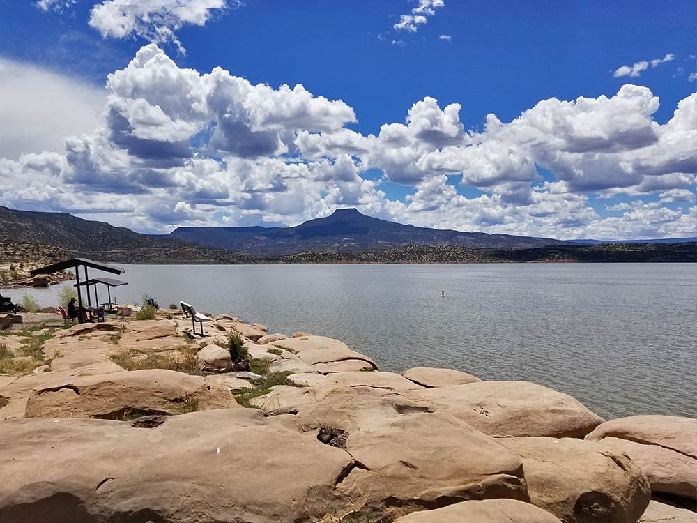
 Image Courtesy of Jessica Rath ~Jessica Rath After an extraordinary long winter which started with freezing temperatures in the first days of November and lasted all the way through April, spring has finally arrived. And, even faster than in other years, spring is almost gone! Just in time for summer, for swimming and kayaking, Abiquiú Lake has nicely filled up with plenty of water. Something that most of us have sorely missed for the last few seasons. Before I moved to New Mexico in 2000, I lived in Berkeley/California. When I told people of my plans, the common reaction was: What?! You’re moving to the desert?! Well, I had visited friends who lived in Santa Fe, and they had taken me to Taos and other gorgeous places in the north, so I knew that I wasn't going to live in a dry, sand-blown desert. But I certainly didn’t expect that I’d end up close to a splendid lake. It didn’t bother me that it is an artificial lake, with a dam to store the Rio Chama water. It was just perfect for swimming, other people were kayaking, sometimes there was even a sailboat. The speed boats – well, one just had to ignore them. But for the last few years, the water level steadily sank until it was too low for the boat ramps. Swimming became dangerous because of blue-green algae. What was going on? I looked at the history of the lake to find out more. 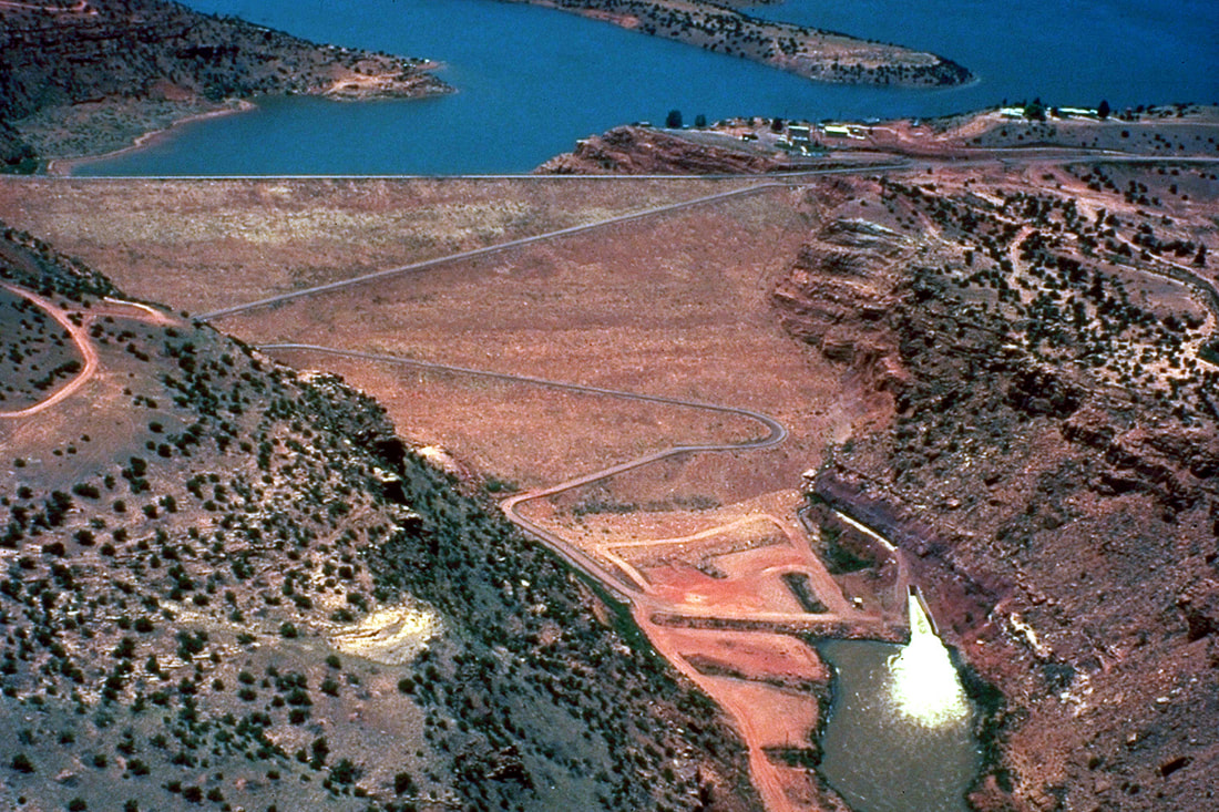 Abiquiu Dam, impounding Abiquiu Lake on the Rio Chama in Rio Arriba County, U.S. Army Corps of Engineers, Photo Public Domain The work on Abiquiu Dam started in 1958. It was created to control the amount of water which would flow from the Rio Chama into the Rio Grande in Espanola. When it was finished, it was considered to be the fourth-largest earth filled dam in the world: 325 (now 340, raised 15 feet in the 80s) feet high, 1,450 (1800 now) feet across from one edge of the canyon to the other, and 2,770 feet from the upstream to the downstream edge. A mile-long conveyor belt had to be installed to bring fill dirt from the borrow areas to near the dam, from where it was transported via dump trucks to wherever it was needed. The dam was completed in 1962, but – surprise! – there wasn’t a lake at all! The dam was used strictly as a flood barrier. Apparently, in the 1970s there were conflicting attitudes about the development of a recreational lake which would flood the area on the north side of the dam. Much of the land was private, and there was concern that the dam wouldn’t be strong enough to hold so much water. On the other hand, the Espanola Chamber of Commerce petitioned for the construction of recreational facilities because of the obvious benefits for local businesses. I don’t know how it happened, but I’m glad they won! With the higher water levels, this summer looks promising as far as swimming and other water activities are concerned. But what about the coming years? Will the water stay high? I wanted to find out and made an appointment with John Mueller, Operations Manager at the Abiquiu Dam (which is part of the U.S.Army Corps of Engineers), who kindly agreed to answer my questions. 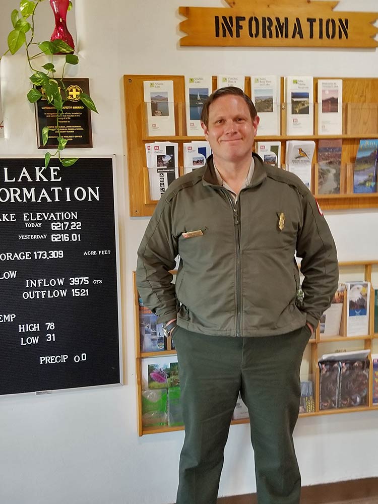 Image Courtesy of Jessica Rath First of all, I wanted to know why the water was so low for the last two years – was it just the drought or were there other reasons? John explained that it was usage, primarily. The purpose of the reservoir was to control flooding from the dam down to Espanola, where the Chama meets the Rio Grande. Initially, there wasn’t much water stored – not enough for swimming etc., it was just a puddle at the bottom. In the spring there was more water, but it was slowed down for flood control, the water was released at a controlled rate. 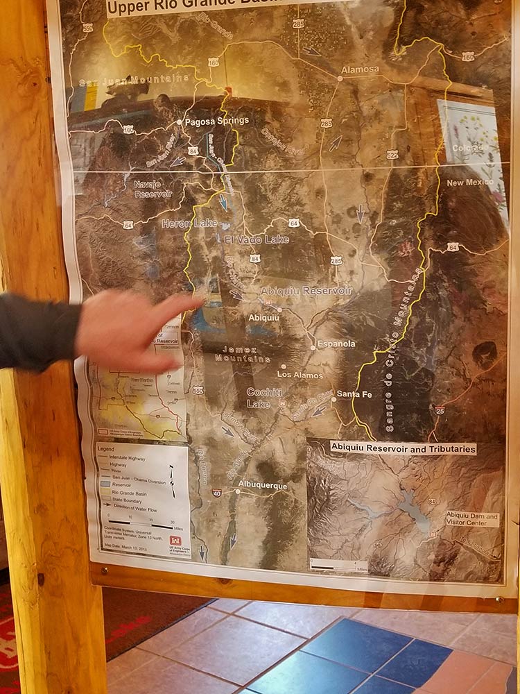 Image Courtesy of Jessica Rath But, in the mid-70s the San Juan Diversion Project changed things. (He shows me on the map). The headwater of the native Chama River is southeast of Pagosa Springs, it flows along the Colorado border, and then into Rio Grande. The Bureau of Reclamation Tunnel is 26 miles long, it collects water from the headwaters of the San Juan River, flows through a tunnel underneath the Continental Divide, and comes out east. It is placed in Heron Reservoir where it connects with the native Chama River. The water is purchased by contractors, municipalities, and water authorities including the City of Albuquerque. They can store it in Heron Lake, and they can store it in El Vado Lake including native (natural Chama, not San Juan-Chama) water. They use it for irrigation and drinking, mainly. In the 70s the water was stored year round for the contractors. They can ask for it whenever they want or need it. “We can’t STORE native water like El Vado does. We can only hold it, slow it down, and eventually release it. The only water that is stored is the San Juan-Chama water, for these contractors, to be sent down when they request it. In the 80s and 90s and early 2000s they were not calling for it, but then when they did ask for it, our water level kept dropping. This is partly related to the drought, and also, Albuquerque is growing and needs more water. For the last 10 years the water level has been reduced.” There is currently legislation and a process that is being developed for Abiquiu Lake to have the ability to store native water in addition to San Juan Chama imported water up to an elevation of 6230 feet, although it is uncertain when this may be implemented. 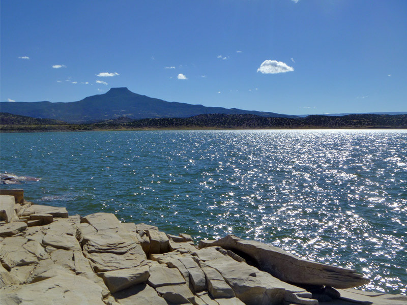 Image Courtesy of Jessica Rath I asked about the blue-green algae. It’s actually NOT an algae John corrected, but a bacteria. It grows in warm, stagnant water with high nutrients such as nitrates, sulfates, etc. from agricultural run-off. Less water, higher temperatures, more nutrients: the perfect growing conditions for algae. “Last year we had more water because the El Vado Dam is being worked on. To do the maintenance, they had to drain their reservoir and we took that water. Also, the snow melt is a contributing factor for the high levels. We have to hold off releasing the water like we normally would at this time of the year, because there are other tributaries like the Ojo River. We have to reduce our release because at the Chamita Gate down there, at the Chevron Station where the Ojo comes in, there would be too much water otherwise. We’re only releasing about half of what comes in. But we’re going to release that water eventually, for agricultural purposes etc.” 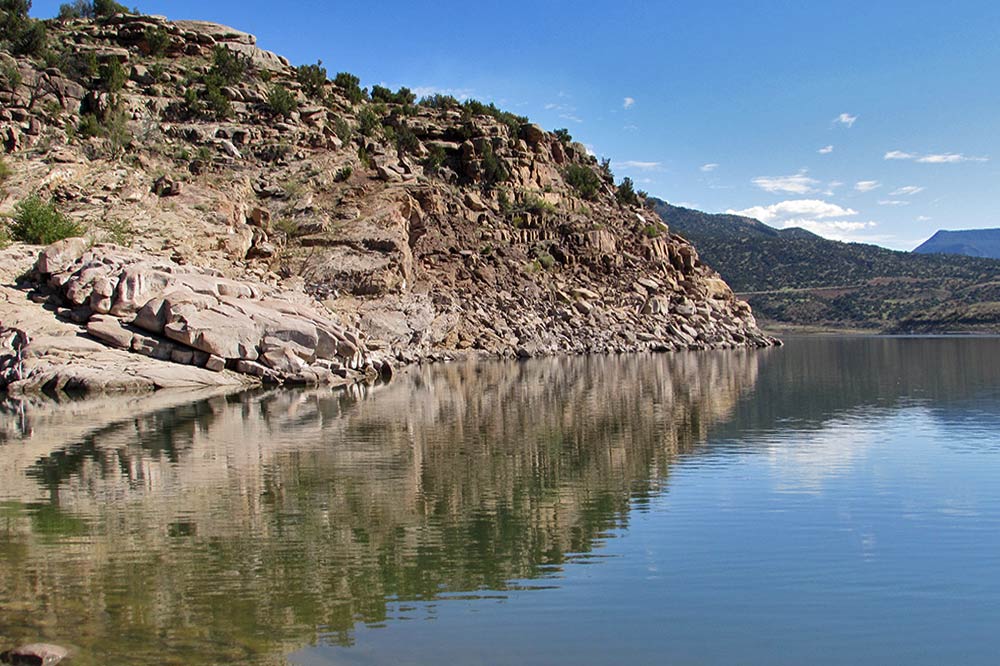 Image Courtesy of Jessica Rath And good news for this summer: “On July 1st whatever we’ll have over will be locked into storage until the end of the season, that’s going to help us keep the water up here. Because of El Vado and the snowpack we have a higher storage through November. Potentially also next year, depending on when they complete the maintenance at El Vado. Right now, it’s a foot and ½ going up every day. We’re at the level of 2013 I think. We're probably gonna come up another 6 feet. However, it will not last. This year and next year, we’ll have a lot of water! Definitely this year, and it’s looking pretty good for next year.” 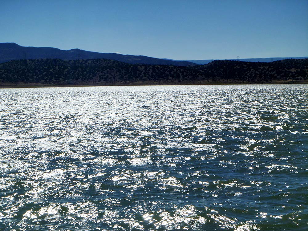 Image Courtesy of Jessica Rath I thanked John for his time and the interesting information and went to the overlook and then to the main boat ramp to take some pictures. There were already some picnickers, some kayakers, and one speed boat. It’s still too cold for swimming, but we can look forward to a glorious summer!
Read More Taos News 4/28/1960 Albuquerque Journal 7/22/61
14 Comments
Robin hardie
5/19/2023 07:59:52 am
Thank you for writing this article. You have answered some of my curiousities. I’m so happy that we get to play in the water this year. What a treat!
Bonnie and Dick
5/19/2023 09:25:40 am
Great, informative article, Jessica!
Jessica Rath
5/20/2023 03:57:11 pm
Thank you! Hope you guys are doing well!
Jessica Rath
5/20/2023 03:56:30 pm
YES, and maybe next year, too! Glad I could answer some of your questions!
Jessica Rath
5/19/2023 10:22:58 am
A concerned citizen emailed the following question:
Zoe
5/20/2023 09:55:50 am
Wasn't there a town that was flooded to create this lake originally? same thing happened in MA - just wondering about history - and any ruins discovered?
Jessica Rath
5/20/2023 04:01:00 pm
Abiquiu Lake doesn't have many ruins if any, I believe, but the El Vado Dam that's being drained right now does: El Vado was a village. I'll drive there soon and take some pictures, if there's anything interesting to see.
doug
5/29/2023 01:36:52 pm
We were just at the lake (5/29) and at what I think is called the boat ramp area (confusingly, not where people seem to put their boats in) the ramp was closed to vehicle traffic. Army Corps of Engineers site says that's because the subsoil is saturated and the road is at risk of damage.
Jessica Rath
5/29/2023 02:17:40 pm
Thank you, Doug; I forwarded your comment to John Mueller, Operations Manager at the Abiquiu Dam, and I'll post it here as soon as I get an answer. He did tell me (as I wrote in the article) that the snow melt contributes to the high water level as well. But this sounds pretty crazy, doesn't it.
Jessica Rath
5/31/2023 11:14:02 am
Hello Doug -- here is the answer I received from John Mueller:
doug
5/31/2023 11:20:30 am
Super helpful! Thank you very much for the quick, informative reply!!
Jessica Rath
5/31/2023 11:27:46 am
You're most welcome. It was an important question; I bet other people were concerned too :)
Mark Mason
6/12/2023 04:10:38 pm
It appears that a LOT of water has been released in early June, 2023.
Jessica Rath
6/14/2023 08:26:10 am
Sorry Mark, I'm not quite sure I understand what you mean. I stopped by at the lake yesterday (6/13) and the little bridge near the swimming area was still under water. If you refer to the river level BELOW the dam, I believe that is totally regulated by the contractors further down -- like Albuquerque. The dam serves as flood control, but the water itself goes to the municipalities further down -- at least, that's how I understood John Mueller's explanations. Your comment will be posted after it is approved.
Leave a Reply. |
Submit your ideas for local feature articles
Profiles Gardening Recipes Observations Birding Essays Hiking AuthorsYou! Archives
October 2025
Categories
All
|
-
Home
- 10/24/2025
- News 10/17/2025
- News 10/10/2025
- News 10/03/2025
- News 09/26/2025
- News 09/19/2025
- News 09/12/2025
- News 09/05/2025
- News 08/29/2025
- News 08/22/2025
- News 08/15/2025
- News 08/08/2025
- News 08/1/2025
- News 07/18/2025
- News 07/11/2025
- News 07/04/2025
- News 06/27/2025
- News 06/20/2025
- News 06/13/2025
- News 06/06/2025
- Criteria for Submissions
- News and Features
- Dining
- Lodging
- Arts
- Bloom Blog
- Classes
- Activities
- Classifieds
- Tech Tips
- Real Estate
- Real Estate by Owner
- Support
 RSS Feed