|
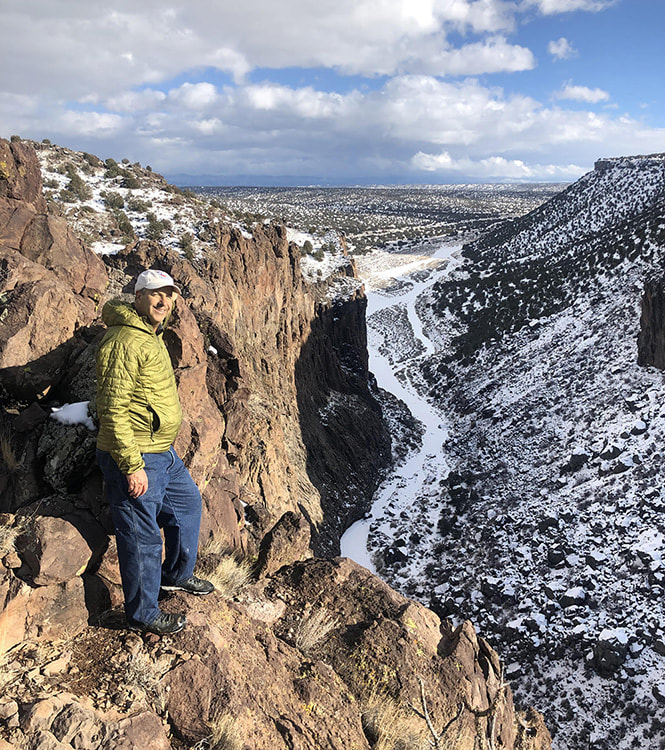
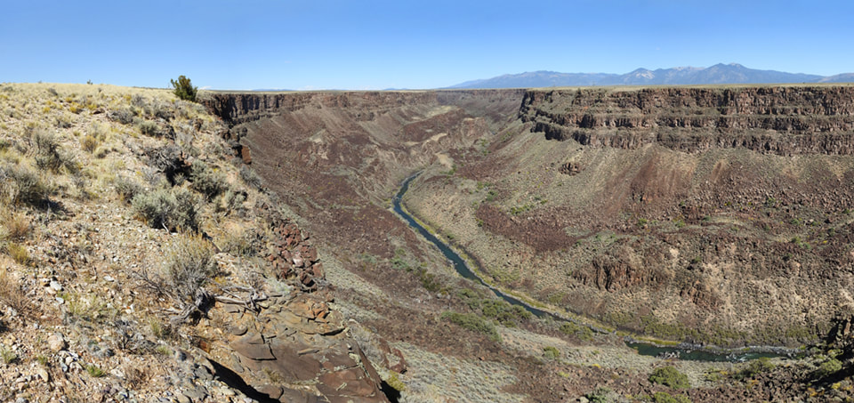
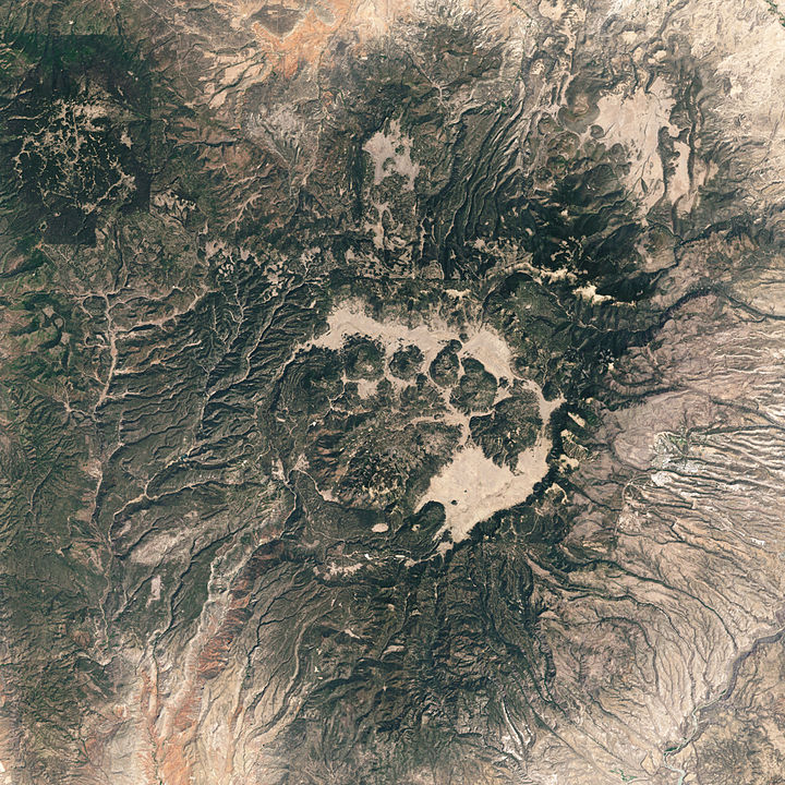
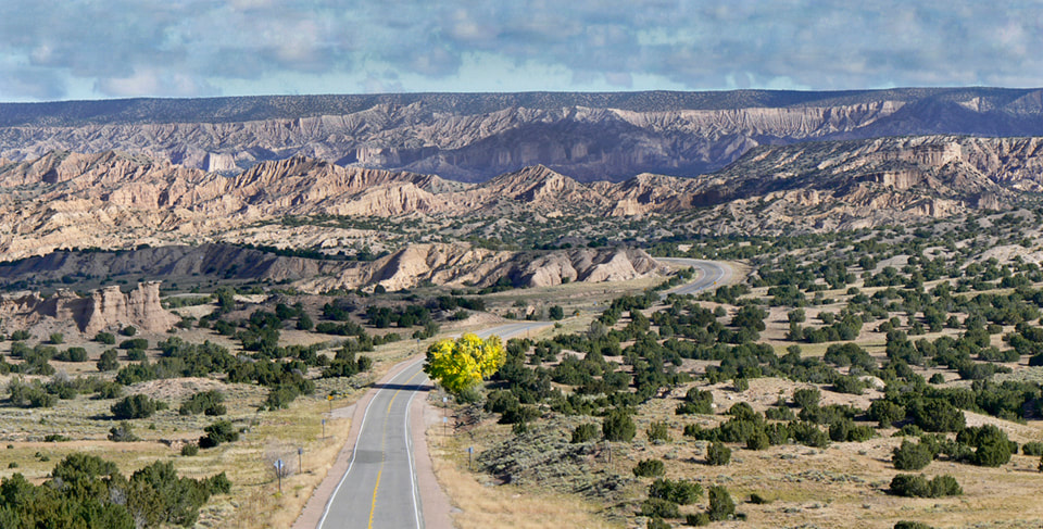
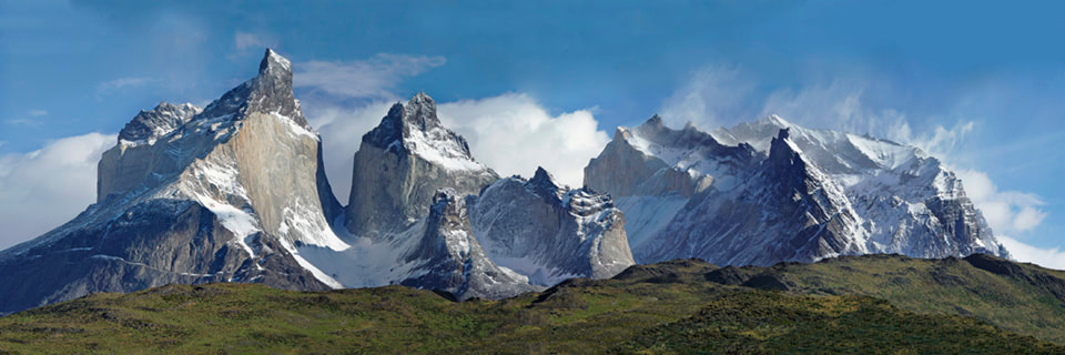
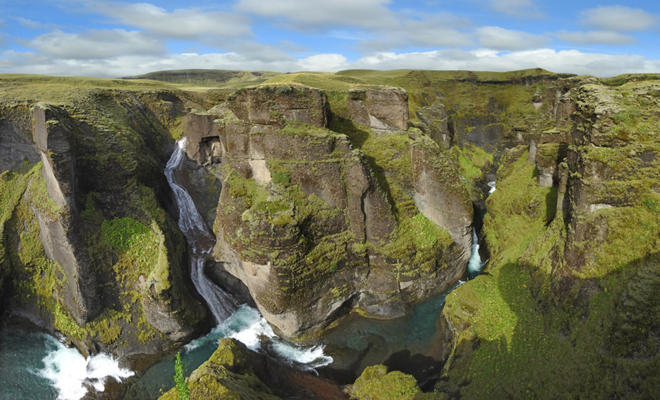
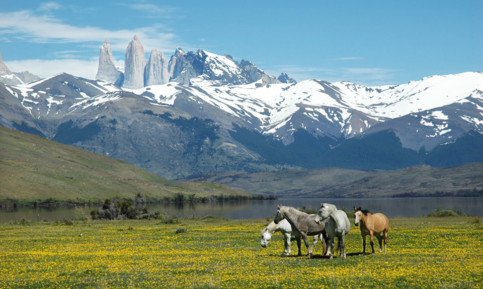
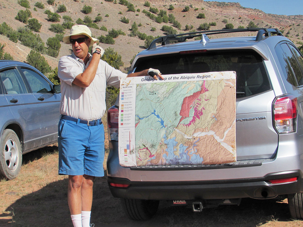
Imagine you’re listening to the audio recording of a book. Suddenly, the speed slows way down, and what normally would take two hours now takes one week, or even one month. You’d still hear something, but it would be a very low hum and you can’t understand the words any more. The meaning of the book is lost. That’s how I as a lay person experience the rock formations, mesas, canyons, and mountains all around me here in northern New Mexico – I certainly appreciate the beauty of the colored layers, the different rock textures, the shapes that can look so other-worldly, but questions such as WHY? HOW? WHEN? remain a mystery. I see a still-photo of a long movie, but it is static. Because I have no understanding of geologic time. Our resident geologist Kirt Kempter compared it to money, when I talked to him recently. When we think of billionaires, most of us can’t really conceive what this entails, it just sounds crazy: one thousand times one million. Geologic time is similar. “When you study geology, once you get your geology degree from college, you know almost nothing”, Kirt explained. “You get introduced to all these various sub-fields: paleontology, geochemistry, geophysics, a bit of historical geology. But it’s not until you start your professional career in geology when you think about this geologic time on a daily basis. You look at the landscape and you see surfaces or geologic events that happened in the past few thousand years. And then you see canyons in New Mexico where the capping lava is a million years old, and here you have this 600 foot deep canyon, for example, along the Rio Chama or the Rio Grande, and you learn that this particular kind of erosion can occur within this particular span of geologic time. So, you’re constantly thinking of these millions of years in the geologic past, and at last, as you deepen into your profession, you feel that you have a good concept, a good grasp of these millions of years. I’m not actually sure that it’s true, but you feel comfortable speaking in this deep-time language”. I was curious: how does one become a geologist? Did he collect rocks as a little kid? Kirt grew up in Albuquerque, and his parents were musicians. They were 100% city-slickers, they were afraid of nature, and they almost never went camping, Kirt explained. “But my friends and I were always going out into vacant lots, catching snakes, catching lizards. I had a whole slew of reptile and amphibian pets, I even had a pet racoon for a while. I was always driven to the outdoors naturally, to my parents’ incomprehension. When I was in Junior High I saw a flyer on the campus of UNM: an ad-hoc group wanted to hike down into the Grand Canyon and raft down the river. This was in 1974, before rafting became popular. I think it was kind of a premonition of me becoming a geologist. I begged my parents to let me go on my own with this group, I didn’t know anybody, I was 14 years old and they let me hike down the Grand Canyon, 18 miles to the river”. He never had Earth Science at school, and it wasn’t until he was a biology major in college that he took Introductory Geology for fun in his junior year. And it ticked off all the things he enjoyed: having a profession where one could be outdoors most of the time; it included biology, the study of paleontology, life on our planet and how it evolved. He changed his major immediately after that class. It was one of those moments in life where one takes a turn and it changes everything after that. “My Bachelor’s was from Colorado College in Colorado Springs, but my Master’s and PhD were from the University of Texas at Austin. Both projects were studying big volcanoes in Latin America. My Master’s thesis was in the Sierra Madre Mountains of Mexico, studying a giant caldera, twice as big as the Valles Caldera, and my PhD project was studying an active volcano in Costa Rica, and this, what I call a “young” volcano, was growing inside a much bigger caldera, also bigger than the Valles Caldera”. I live in Coyote, and all along the roads one can find agates and other rocks that apparently stem from the big “SuperVolcano” eruption at Valles Caldera. I asked Kirt to tell me more about that. “Yes, the pyroclastic flow from Valles Caldera went as far as Coyote. There were two giant eruptions in the Jemez Mountains. The first one was 1.6 million years ago, which made the caldera we call the Toledo Caldera. Then, 350,000 years later, the Valles Caldera forms in the same place, with the same volume of magma, the same chemistry of magma; the exact same eruption happened 350,000 years apart. The Valles eruption started off as a single vent that was really powerful going up tens of kilometers into the stratosphere, but then it transitioned into multiple vents tapping into the magma chamber. These multiple vents were not as energetic as the single vent, so these multiple eruption columns were going up maybe five kilometers high, and collapsing, and sending out pyroclastic flows. These are turbulent clouds of hot gasses, magma particles, and rock fragments that can flow across the landscape at speeds of one hundred, even two hundred miles per hour. And the topography of the surrounding area of the eruption vents dictated where those pyroclastic flows went. So for those of us in the Rio Chama Valley, in the Abiquiu area, there were high topographic features like Chicoma Peak, Polvadera Peak, and a high plateau called the La Grulla Plateau. These highlands kind of blocked the pyroclastic flows. But then there were low areas to the north and to the northwest towards Coyote. That's where the pyroclastic flows were able to flow for many kilometers, probably 20 kilometers away. So yeah, if you had been in the Coyote area 1.2 5 million years ago, you wouldn't have survived!” “What's neat though about these pyroclastic flows, there were previous canyons like Cañones Creek and the one in Youngsville, the Rio Puerco. There were already canyons that existed before the eruption. And these canyons filled up with the pyroclastic flows. Once they had solidified, they became what we call the Upper Bandelier Tuff. And what’s so amazing is these giant eruptions transform the typography in the blink of an eye. They fill up canyons, and so they totally can change where rivers once flowed. New rivers have to form afterwards. I love catastrophism in geology! Certainly, these big volcanic eruptions, like the Valles, are catastrophic and change the landscape in just a few days. We're not looking at geologic time, we're looking at hours and days that totally changed the landscape story”. This reminded me of the little earthquake we had in this area last year. Was this related to the volcanic activity at Valles Caldera? Kirt had a surprising explanation: “You live in a transition zone between the Rio Grande Rift, which is the Española Valley that's to the east of you, and the Colorado Plateau, which is all the land to the west of you. So we have this geologic boundary, the Colorado Plateau to the west, the Rio Grande Rift to the east. The Colorado Plateau is trying to pull away from the rest of New Mexico. And as it is doing that, we have this tear in the crust in New Mexico called the Rio Grande Rift. Along the rift boundaries, the basins keep dropping down over time, filling up with sediments and volcanic deposits. And so, since you live in that transition zone between the Colorado Plateau and Rio Grande Rift, we get more earthquakes there, based on this pulling apart of New Mexico”. “In general, when the crust is pulling apart, this results in smaller earthquakes. When you have geologic boundaries, like the San Andreas Fault in California where there's a lot of compression and stress, you tend to get the bigger earthquakes. The rocks in geologic zones on either side of a fault experience compression and there's a lot of friction. Stress and strain keep building up until finally it has to release in a big earthquake. When the crust is just pulling apart, then you always have these little earthquakes. So we don't tend to get the big magnitude-seven earthquakes. Now, I say that we don't tend to, but that's not to say it's impossible”. I had no idea that there were two different kinds of earthquakes. Having experienced the San Francisco earthquake of 1989 I feel a sense of relief. Kirt has led many tours both for the Smithsonian Institution and for National Geographic Expeditions. I asked him how this came about? It kind of fell into his lap, Kirt tells me. In 1993, when he was working on his PhD and studying a volcano in Costa Rica, one of his committee members was a volcanologist at the Smithsonian, Bill Nelson. Smithsonian was starting one of their educational tours to Costa Rica and they asked Dr. Nelson if he could lead the tour. He was too busy, but he recommended Kirt. So Kirt led his first tour in 1993 to Costa Rica, and because it went really well they asked him to do a few more. At first he would just do a couple of tours a year, but then they started giving him more tours, even to places he didn’t know. In 1995 they were starting a tour to Iceland and asked if he could manage although he had never been there. And it went well. “So then they started letting me go anywhere. I started doing tours to Patagonia, and just all over – to places where the landscape was the focal point of the tour. I found that I could lead tours to places I’d never been because you're basically teaching introductory geology to lay people as you travel. So, if we're going to Iceland, for example, I need to teach the basics about volcanoes. Also, teach basic plate tectonics and glaciology. So, more than half of the teaching on these tours is basic geology so that people can understand these geologic processes that are forming the landscape”. “For 25 years, I would do these educational tours all over. National Geographic had a big educational tour program. For about 20-some years I did, on average, eight international tours a year. And it was great. I loved it. But I've retired from doing those big trips now. However, I had told National Geographic that if they ever do a tour to the Kimberley region of Australia, I would be back in. Well, they did call me up about a month ago and told me that they have a tour to the Kimberley! So I have agreed to do one more tour next year. It includes Northwest Australia and some of the islands of Indonesia”. I asked Kirt to talk a bit about Iceland. He had been there several times. “Yeah, Iceland is unique on our planet. There are frequent eruptions, about one every four years somewhere in Iceland. And what makes Iceland particularly interesting is the last two million years – which means young geologic time. Most of those eruptions have happened underneath ice. You get very, very odd volcanoes when you're forming a volcano underneath an ice sheet. You get these very different types of eruptions and shapes of volcanoes. The combination of fire and ice is young geology, we find really, really young geology in Iceland. And I love that”. What’s another favorite spot on Earth? “In South America I love Patagonia, and in particular, one part called Torres del Paine. I've probably done a dozen tours to Patagonia which is part of Chile, and it's just gorgeous. It's like South America's Yellowstone. There’s lots and lots of wildlife – guanacos, camels, pumas, rheas which are ostrich-like birds, and the condors”. Wait a minute. Did you say camels? In South America? “Yes, there's a whole branch of camels that evolved in North America and that went extinct in the Ice Age, but they migrated into South America. So when you think of llamas, they are part of the guanacos of South America. There's a whole family of camels that evolved in North and South America”. “Sometimes geology can bring continents together, and the different flora and fauna can mix. And sometimes geology can separate landmasses. And then very different animals and plants evolve if we have a geologic separation or barrier. So yeah, that is the camel story of South America. It is really interesting because it relates to North and South America, joining together through the Panama Isthmus. That land bridge connection where Panama is today is a young connection between North and South America”. I’m surprised again. “You mean it came out of the ocean?” “Yes. If we go back in time five million years ago, there was still an ocean connection between the Pacific and the Atlantic, through southern Central America. But when all these volcanoes started to come up above sea level, they got bigger and joined together. Eventually they formed a land bridge connecting North and South America that for the first time allowed animals to migrate from south to north and vice versa. If you see an armadillo or a possum in North America, they walked up from South America” This is so fascinating, and again, I had no idea! We were reaching the end of our interview, and I wanted to know what Kirt was up to these days. He had said earlier that he wasn’t doing long educational tours any more, but still offered day tours out of Santa Fe. What else is he involved with these days? Since 2000, Kirt’s career has involved making geological maps. Funded mostly through the US Geological Survey, that’s how he came to know the Abiquiu area so well, starting in the Jemez Mountains, moving down to the Rio Chama Valley, then moving north to El Rito, eventually to Las Tablas and Tres Piedras. Falling in love with the landscape has helped with the many years of making geological maps.
“When I’m hiking I’m trying to read the rocks and read the landscape. This adds a deeper dimension to my aesthetic appreciation. Trying to understand what all those rocks tell you – how can there have been an ocean here? Sand dunes? A river the size of the Mississippi? It’s mind boggling, but those are the environments of northern New Mexico at different times in the past. As a teacher, I enjoy taking people – non-geologists – on these trips, and I try to paint the picture that I see in my mind, from the story that I’m reading.” This was a most fascinating conversation, and I thank Kirt for taking the time to share this wonderful information with us. I felt I was looking through 3-D glasses while I was listening, whereas normally all I see is a two-dimensional image. If you want to see more of his photographs, you can visit GeoMosaics.
8 Comments
John Evaskovich
9/8/2023 11:56:07 am
Thanks for this, Jessica.
Reply
Jessica
9/13/2023 02:42:56 pm
Yes, John, I totally agree: when Kirt talks about our magnificent landscape, he adds a whole new dimension. He opens our eyes. Glad you liked it!
Reply
9/15/2023 08:19:36 am
Wondering where we might find a calendar of walks/talks around Abiquiu in the upcoming months.
Reply
Jessica
9/16/2023 09:21:13 am
Lauren -- the A.News has a page with hiking info: Activities/Classes (https://abiquiunews.com/activities--classes.html). And Kirt Kempter does fabulous local trips/hikes; please contact him to be put on his mailing list: [email protected].
Reply
Jessica
9/16/2023 09:22:06 am
Glad you enjoyed the post, Carolyn!
Reply
Greg Corning
12/3/2023 08:02:15 pm
Your introduction is simply eloquent. I have read about geology for decades, and I have *never* read such a beautiful explanation of the disconnect between our human sense of time and the time scale in which the Earth works.
Reply
Jessica Rath
12/6/2023 03:52:55 pm
I had to smile while I read your comment. I was born and grew up in Germany, and 450 years isn't very old there. It's all relative... But I understand what you're saying about deep time. It boggles the mind indeed. And yet, somebody like Kirt who has involved himself in and studied it for years and years, geologic time reveals many of its mysteries. It's like a foreign language, at first it's totally incomprehensible, but if you stick with it long enough, live in the country f.e., eventually you'll understand a lot. Thank you, Greg, for the thoughtful comment!
Reply
Your comment will be posted after it is approved.
Leave a Reply. |
Submit your ideas for local feature articles
Profiles Gardening Recipes Observations Birding Essays Hiking AuthorsYou! Archives
October 2025
Categories
All
|
 RSS Feed