|
FOR IMMEDIATE RELEASE
CONTACT: Mattie Allen [email protected] 505-423-3360 Santa Fe, NM – This May, Violet Crown Cinema marks its 10th anniversary by partnering with Española Humane and other local nonprofits for a series of classic film screenings. All ticket proceeds from these screenings will support the work of these organizations. Española Humane will present "Best in Show," the beloved 2000 mockumentary comedy co-written by Christopher Guest and Eugene Levy. The screening will take place on May 9 at 6:30 p.m. at Violet Crown Cinema in the Railyard District, 1606 Alcaldesa St. Prior to the screening, a complimentary popcorn reception will start at 5:30 p.m., offering guests a chance to learn more about the shelter’s impactful work. "We’re honored to be part of Violet Crown’s celebration and grateful for their support," said Kate Baldwin, Executive Director of Española Humane. "Nothing fosters community spirit quite like the shared love of film – except maybe adopting a dog or cat into a loving home." The cinema’s restaurant and bar will be open for guests to purchase food and drinks during the reception and screenings. Additional showings of "Best in Show" will be held on May 12, 13, and 14. For ticket details and prices, visit santafe.violetcrown.com. In addition to showcasing classic films to benefit nonprofits, Violet Crown will also feature significant movies from its 10-year history throughout the month. These include the highest-grossing New Mexico production and the longest-running film at Violet Crown. "We are grateful to the Santa Fe community for their support over the past decade," said Bill Banowsky, owner of Violet Crown. "Our aim has been to provide an exceptional moviegoing experience, and we look forward to many more years with our Santa Fe audience." As Violet Crown celebrates this milestone, the cinema continues to evolve with the latest projection and sound technology, a popular café and bar, and a diverse selection of films catering to every taste. "We take pride in serving as a platform for independent voices and nurturing artistic expression," said Peter Grendle, Director of Programming at Violet Crown. "From thought-provoking documentaries to groundbreaking experimental works and major Hollywood releases, we've had the privilege of showcasing the best in cinema. Our anniversary celebration is a tribute to the artists, filmmakers, and community members who have supported us. We invite the Santa Fe community to join us in May for these special screenings, with 100% of ticket proceeds from 30 benefit screenings going to our nonprofit partners." ### Española Humane’s mission is to end animal suffering in underserved communities in Northern New Mexico communities and services are free to at-risk animals in Rio Arriba County and beyond. To learn more about how you can help, visit espanolahumane.org.
0 Comments
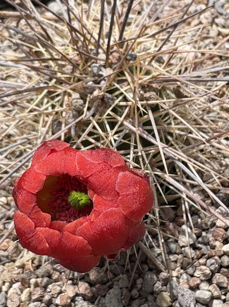
By Felicia Fredd 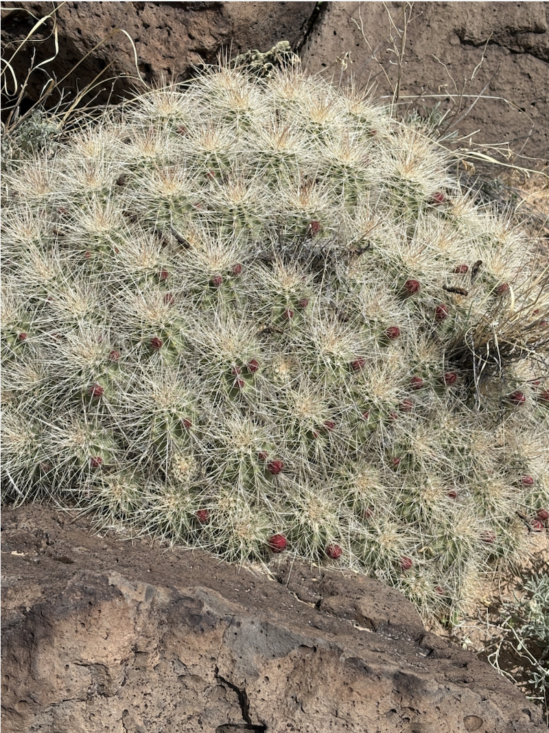 About two weeks ago, I spotted my first hummingbird visitor - just a quick flash and buzz of one checking out an empty feeder. About 3 days ago, my claret cup cactus began to bloom. I looked into this coincidence, and learned that the stunning claret cup flower was made for the hummingbird, and timed for its arrival. “In addition to color, its flowers are distinctive for shape, morphology and timing of availability… Bees, butterflies and flies are also common cactus pollinators, but hummingbirds are the most common pollinators for claret cups. To take a sip from the nectar chamber deep in a claret cup, the hummingbird must stick its whole head into the flower. Its bill, face and the top of its head rub against both the stigma and the collar of anthers as it penetrates the flower, assuring the transfer of pollen.” https://www.colorado.edu/asmagazine/2018/05/30/hummingbirds-pollinate-claret-cup-cactus
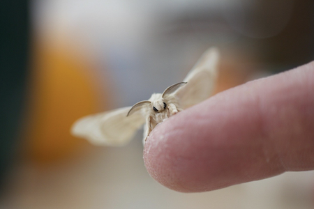
Here’s another cool symbiotic desert relationship: the yucca moth & native yucca which can be seen blooming in Abiquiu right now. In a few more days, you’ll be able to find these pure white moths, Tegeticula sp., within individual yucca flower cups - pollinating, and eventually laying next year’s eggs.
“The relationship between yucca moths and yucca plants is an example of obligate mutualism. Many species of yucca plant can be pollinated by only one species of yucca moth, while those yucca moths use the yucca flowers as a safe space to lay their eggs. https://ir.lib.uwo.ca/wurjhns/vol8/iss1/10/ and https://www.fs.usda.gov/wildflowers/pollinators/pollinator-of-the-month/yucca_moths.shtml
These are just two examples of inconceivable (!) numbers of incredible relationships within our local food web (I remind myself of Vizzini’s character in the movie ‘The Princess Bride’ from the 1980’s). It is also the subject of University of Delaware wildlife ecologist Douglas Tallamy’s, second principle of Universal Landscape Goals: they (garden and landscape) must provide energy for the local food webs. https://homegrownnationalpark.org/4-universal-landscape-goals/. I have not read Dr. Tallamy’s book. No time. It certainly would have been helpful, but this second principle considers all things native from the perspective of unique ecosystem energy dynamics. Native species have evolved together within their environments to access and transfer energy in the most efficient and sustainable forms for each successive user. In the broadest conceptual sense the food web appears very simple. Up close however, it becomes apparent that it is very complex and vulnerable. It’s a bit of a super intricate Jenga puzzle. Environmental collapse is a closely related concept. I personally feel very strongly that ecology can’t be ignored anymore, and I know that there is nothing to lose, everything to gain, and no real obstacle to supporting environment by using native plants in garden and landscape outside of actual plant and seed market availability. That’s the big one. Aside from that ever so aggravating issue, I see potential every time I go walking in the hills where I discover beautiful plants, or beautiful aesthetic effects presented by light, moisture, or contextual conditions. I don’t know if anyone out there will get this, but the Japanese art of Ikebana, translates into “making flowers come alive” - not making them more beautiful, but making them come alive in one’s perception. This is what we do with design in general - we try to bring a presence to things through physical relationships that produce a compelling feeling or effect, or to embody a concept. This could be a lot of things, but the Japanese words ‘ma’ and ‘kekkai’ refer to an awareness of space (most importantly empty space) and boundaries within & between forms to do this, roughly speaking. As a form of meditation, Ikebana is also a practice of cultivating presence, and an openness to feeling. I’ve also heard it called ‘making flowers human’ in recognition of the fact that it’s all about appealing to human perception. ‘Freakebana’, “The turnt cousin of Ikebana”, is also insanely interesting because it brings the traditional principles of ikebana to the arrangement of a bunch of pretty weird stuff - the seeming absurdity of which allows one to see even more clearly the intelligence behind the original buddhist practice. ‘Freakebana’ playfully illustrates that it is not materials per se, but design relationships that raise things to levels of surreal, or hyper-real ‘beauty’. Gardens are places of concentrated beauty, whatever that means to individual people, and it’s another very important aspect of ecological gardening that I am exploring. I think this is where ecology meets the human psyche. Tina Trout Bio Returning to New Mexico after 25 years away, Tina sold her home and cooperative artist residency to embrace life on the move, living in a converted bus and trailer with her herd of goats. Trained in permaculture, natural farming, alchemy, and guided by a lifelong spiritual path, she discovered that grand ideas mean little without soil under your nails. Tina lives her insights in real time, from chili seeds to crafting wild medicines. Her early explorations in Web3, launching Microbe Heroes NFTs and designing decentralized, shared-economy frameworks, revealed a profound truth: communities need more than visionary ideas; they need hands-on engagement. This led to her signature Goat Walk gatherings, where pattern literacy and regenerative practice become living community workshops. Out of these experiments, she wove the Natural Being Framework, a dynamic map built on the pillars of Being → Having → Doing → Interacting. It’s designed to satisfy all our fundamental needs, in any place or condition, by honoring nature’s redundancies and emergent synergies. Tina’s purpose is to guide people back into direct engagement with land and each other, showing that the truest path to love, power, and wisdom is lived in the earth beneath our feet. Her writings appear on Substack, blending practical reflections with a sci-fi time-travel saga, layering ideas through nuanced journeys across time, place, and shifting “skins” of identity and memory. The Goat Walk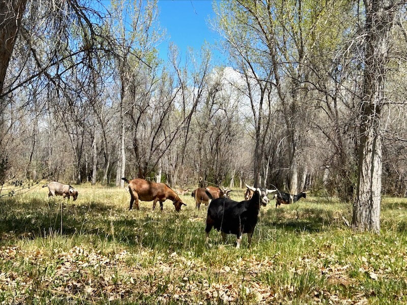 Field Notes on Failure, Feedback, and Emergent Pattern Literacy By Tina Trout Every morning, I walk goats with sunflower seeds in my pocket. Seems simple, romantic even but really, it’s a live exercise in pattern recognition, relational feedback, and what physics calls emergence from the edge of chaos. I call it The Goat Walk, and over time it’s become practice, template, meme. Introducing Natural Being through The Goat Walk Natural Being is a living framework, a cyclical map for co-learning with dynamic systems, soil, herds, or communities. Two core insights drive it: Pattern Literacy I attune deeply before acting, using a Three-Step Method, an informed Try-Fail-Try again loop, to turn “failure” into feedback as a teacher, revealing emergent intelligence over imposed control. Stacked Functions Every practice is designed to meet multiple needs at once (health, ecology, creativity, community). The more needs a single action meets, the more regenerative the system becomes. This unfolds through four interwoven phases: 🜃 Being (Listening Before Acting): Cultivate presence and observation as your first move. 🜄 Having (Recognizing What Emerges): Take stock of resources, feedback, and stacked functions. 🜂 Doing (Iterative Experimentation): Engage in three-cycle, edge-of-chaos experiments to co-discover new rhythms. 🜁 Interacting (Co-Creating Emergence): Step into right relationship, letting listening and participation shape the evolving field. Underpinning it all is the Triune of Love, Power, Wisdom, from microbial magnetism to self-knowledge as data to applied insight, and a commitment to right relationship drawn from Indigenous pattern-literacy, complexity science, and embodied practice. Natural Being turns every step into a canvas for regenerative learning. Now, back to The Goat Walk Each Goat Walk surfaces something new: A shift in herd dynamics. A reward that no longer works. The call for fresh negotiation, fresh trust, fresh rhythm. So I begin with being… 🜃 BEING, Listening Before Acting I walk at goat pace, negotiating each step based on terrain, weather, and herd mood. They may remember the favored apple tree or alfalfa they discovered yesterday, requiring urgency to move them towards wilder pasture, away from crops or property lines. Every walk is different. Every walk is discovery. David, the orphaned kid with digestion woes, spent grazing time cradled in my lap, nosing my chin for comfort. I’d lost two siblings to rumen issues. Without this daily observation, sensitive biomes can quickly fail. The Goat Walk is my observation time with him and all of my small herd, whom I call by name, like counting. 🜄 HAVING — Recognizing What Emerges Take inventory of your stacked functions. On each Goat Walk we’re: exercising me, the goats, and my shepherd dog Sahaj; monitoring goat health; regenerating pasture; strengthening neighbor relationships; scanning soil and plants; even writing and contemplating, feet to soil. The Goat Walk teaches me negotiation with life. I map what I have: pasture capacity, grazing patterns, fence effects, remembered trails, and the quiet currency of intuition gleaned by walking the land every day. What emerges isn’t just goats and function, but relationship in motion. I begin to access a map of response and negotiation. 🜂 DOING — Iterative Experimentation The pattern emerges. I adapt route, timing, and call-and-response through at least three Try–Fail cycles until new rhythms reveal themselves, and then I integrate what I learn. We always finish with sunflower-seed currency and a dash home. Topaz, my oldest wether, demands kisses. I have a special whistle when they wander. At the edge of chaos, complexity science’s sweet spot, we evolve. The babies test boundaries, running into the orchard. I learn to negotiate and compromise as they grow, changing the system. Now the daily Goat Walk becomes practice in Guidance, Trust-Building, Gentle Boundary Work, and Energy Listening, a choreography of Reciprocal Design. 🜁 INTERACTING — Mapping What Has No Precedent Stepping into right relationship. This pattern isn’t in any manual. it doesn’t mirror modern goat-care myths, most of which are fabricated lies based on rumor. I’m learning to read my own map. Indigenous wisdom reminds us: pattern literacy emerges from watching, listening, and walking the land daily. “True knowledge comes from the pattern, not the part,” as Tyson Yunkaporta says (founder, podcast host, and executive editor of Emergence Magazine). In physics, toroidal fields, from hearts to galaxies, merge only when phase, resonance, and proximity align. So it is with goats, people, place. Emergence isn’t linear, it’s relational, vortex-shaped. Spirals. The Goat Walk as Template, is… A metaphor for participatory systems learning A case study in adaptive rhythm-making A feedback engine for growth A relational intelligence practice training presence, flexibility, and co-creation Finally, I don’t control the goats. I cohere with them, We enter right relationship together. And perhaps most beautifully, we stay long enough to see the pattern emerge. 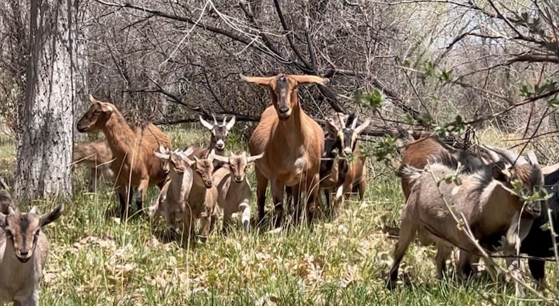 Interview with Katherine Eagleson, founder of Abiquiú Lake Amigos. By Jessica Rath 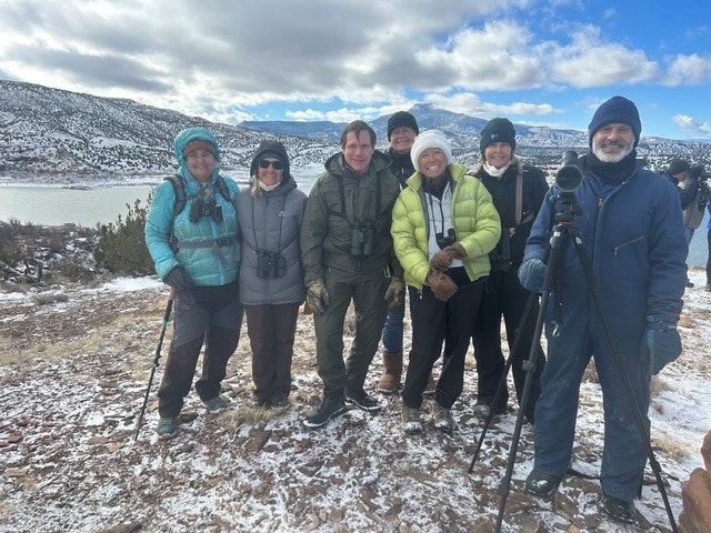 Annual Bald Eagle Count. Image credit: Army Corps of Engineers. When you think of a beautiful lake, what comes to mind first? I bet it’s swimming, maybe kayaking, or sailboarding, or some other recreational water activities. That’s the image most of us would conjure up. However, a lake has a lot more to offer to those who are interested: the birds and the insects one can see, the water quality, or checking boats for invasive species. Abiquiú Lake Amigos, a group with about twelve dedicated members, concerns itself with these more scientific projects. Katherine Eagleson formally started the group in 2023. She was kind enough to meet with me and explain what they do, and also, how she got into this: she’s a biologist who grew up in Iowa but has lived in northern New Mexico for 35 years. From around 2011 onward she did volunteer work for the Army Corps of Engineers, and when she retired, she started the Amigos group to continue with the survey of the water quality. They added bird surveys on the lake and down the Chama River for three miles below the dam, and also began to do pollinator studies: bees and butterflies. 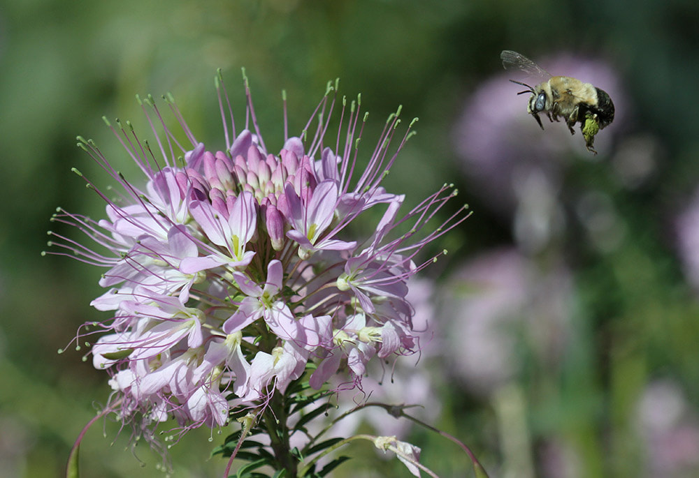 Bee pollinators: monitoring the pollinator and the plant. Image credit: Katherine Eagleson. “Butterflies are the easiest to identify,” Katherine continued. “Generally, bees are hard to identify, but they're very important pollinators. Pollinators in the United States have decreased by 45% and when such a large part of a population is declining, it affects the birds that are insectivores. It’s definitely going to have some impact on warblers and fly catchers, and we are monitoring both of those.” The decline in abundance and diversity of insect pollinators due to habitat loss, pesticide use, climate change, and other factors has been observed worldwide. Bird populations in the U.S. are declining too at an alarming rate, and bird watching/surveying is a critical part of recovery efforts, according to this Audubon article. 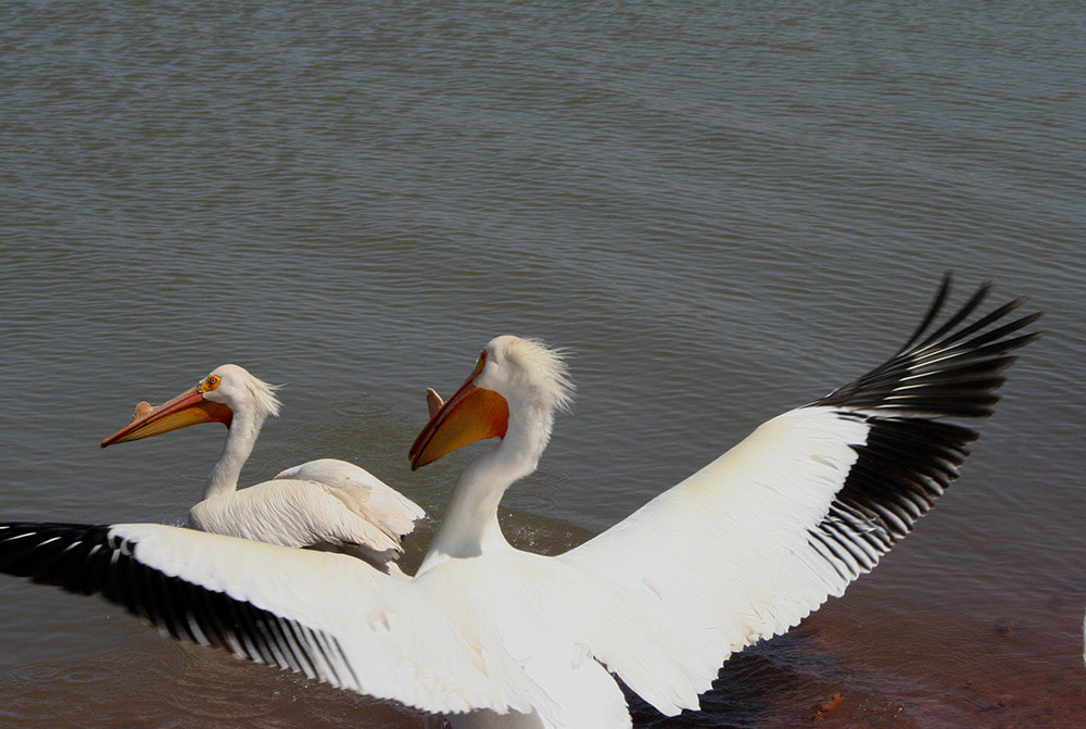 White pelican: a species that migrates through, an important stop on their way to breeding areas. Image credit: Image credit: Katherine Eagleson. “There’a a book about where to find birds in New Mexico,” Katherine told me. “The last version I had basically said, don't bother with Abiquiú Lake. There's nothing happening there. This was some years ago, but it’s wrong, because the lake is part of an important migratory route. The birds that we see in April on the lake are migrant birds. We even had a loon last year. It's an important stopover, and that's becoming more and more important in people's consciousness. It's not so much about what birds are here right now, but where they're going. Are we part of that journey? And if we're part of that journey, then we have to make sure that these animals, the birds, the insects, mammals, the reptiles, that they have a place of refuge and can fuel up for the next stage. Every step of the way is important, not just where they breed and not just where they winter. But every step along one way is a continuation of their journey.” “We have three kestrel boxes. Kestrels have declined 45%, nearly half of kestrels have been lost in the United States, and it's probably their nest sites. They're cavity nesters. So we've put up some nest boxes, and we're monitoring those. We put up boxes for Juniper tit mice, because they're also cavity nesters. That work is important. You know the old adage, ‘Think globally and work locally.’ ‘What can I do in my backyard?’ Because we're one of the steps in the birds’ journey.” I love this idea. For the Amigos the Abiquiú Lake isn’t an independent, isolated location but one step in the journey back and forth. It’s part of a larger, dynamic picture. Katherine illustrated this wider view with an example: “We don't have very many nesting bald eagles in New Mexico, but we have a lot of bald eagles that migrate into Mexico in the winter time. So we keep track of that. How many are coming in, how many are staying, does the lake level have anything to do with how many eagles we have? Does the icing level have anything to do with the number of eagles we have? And now we have quite a bit of data, because we've been doing this for quite a number of years.” 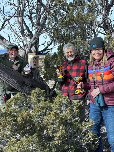 Willie, Ann, and Pam putting up nest boxes. Image credit: Army Corps of Engineers. When did you start, I wanted to know. “I think I started in 2011 with the Army Corps of Engineers,” Katherine replied. “I started with a few of my friends here, and they have friends; they're all outdoor people, and they've become interested. And some of them, a couple, Ann and Willie, are really good birders, and Susan's really getting up to speed on water quality. We have some new members who are interested in various aspects of it. So, we're not out trying to get a hundred people in the group. We're trying to get a cadre of people who are really interested in participating on a regular and sustained basis because that's how you can collect data. We started with about six, and at the last meeting we had maybe twelve, so it is growing.”  Willie helping with boat inspection for invasive aquatic species. Image credit: Army Corps of Engineers. “We have ten stops along the Chama River where we do a bird count every month,” Katherine added. “Now we will do them almost every week for the next three months, because it’s breeding season. We have all kinds of warblers and fly catchers coming in. We have migrants going across. I saw an osprey yesterday moving through. So we have set times, but we also say, if you're out there and you happen to see something, or if you can’t do all ten but you do the first four stops, send me your data. Because, you know, I'm not interested in keeping the data from a certain date, but we want to know what's moving through here, what's nesting here? What bird has successful nests? That's the data we want. Anybody can go out and send me their data once they learn what we're doing.” How often do you have meetings, I wanted to know. “On average, we have about six meetings a year,” Katherine answered. “We have more right now, because we will be working with the Army Corps of Engineers on Earth Day for the Earth Day activities. A couple of times a year they have activities at the lake that we help with. We built the titmouse boxes last fall on the Public Lands Day, and we put them up this spring. A number of activities are planned for this year’s Earth Day celebration.” “We're also going to help with checking boats for invasive species, the quagga mussels and zebra mussels. They're very short staffed at the lake. The Army Corps of Engineers is making a great effort up there. They care about the environment, they care about their impact, and they want to engage the public.” 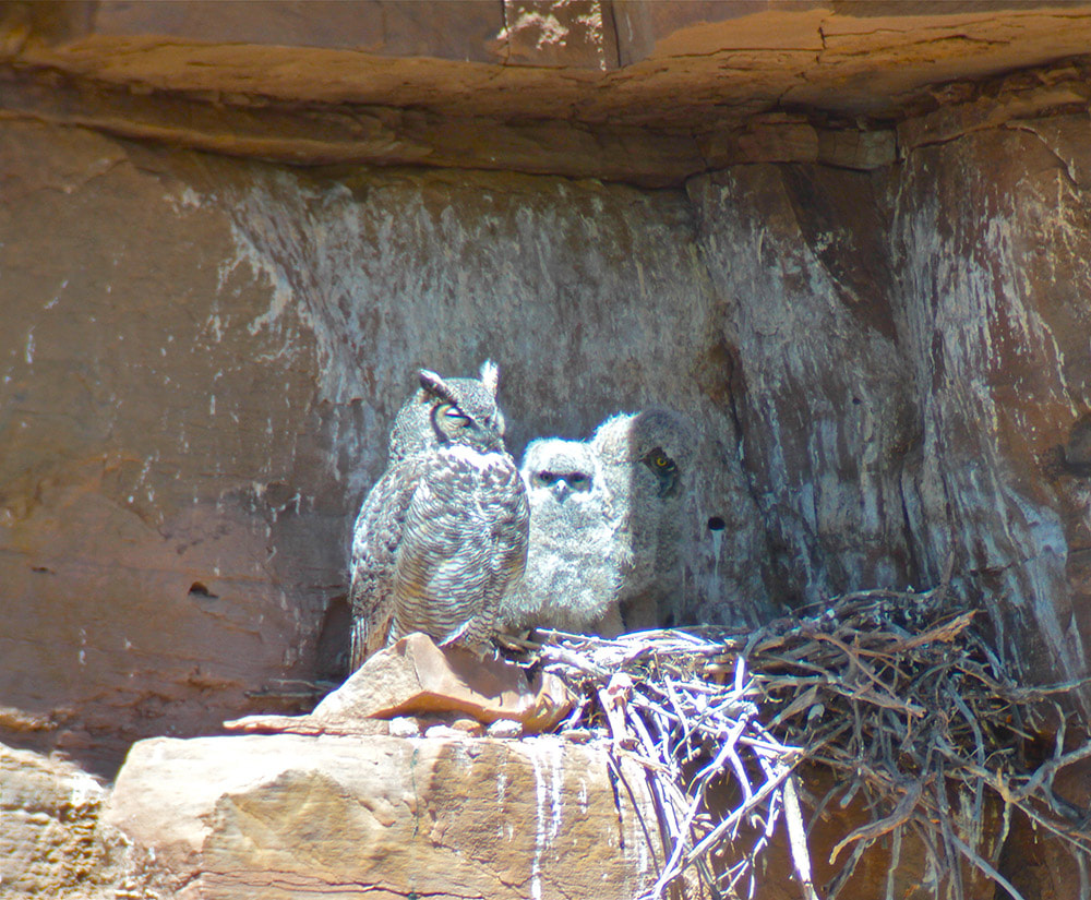 Great horned owl and owlets: monitoring resident breeding. Image credit: Image credit: Katherine Eagleson. Next, I asked Katherine about the poisonous blue green algae. I remember reading the warnings, especially for young children and dogs, because the water can become highly toxic. Katherine corrected me by stating that we’re talking about cyanobacteria, not algae, and that almost every lake gets them at a certain temperature. But when they reach a certain level they can become toxic. Cyanobacteria are not toxic at every level, Katherine explained. When they start to die, they deplete the oxygen level in the water, and that’s when they can become fatal for birds and mammals. Warming temperatures cause those blooms to happen. “Pretty much every pond water in the southern United States is going to have cyanobacteria. But how much circulation is there? How much fresh water is coming into the lake, what is the temperature of the lake, all those things can have an impact.” 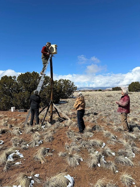 Putting up Kestrel nest boxes. Image credit: Army Corps of Engineers. “The Army Corps of Engineers has a pretty robust water quality testing process now, it collects samples, checks for oxygen, checks for turbidity, checks for conductivity. And they collect samples to check for invasive species, mainly the quagga mussels and zebra mussels. Because they're microscopic when they come in, you have to collect the samples and send them in. You can't see them at that early stage. When we check the boats we're not looking for mussels. What we're looking for is, is there standing water, and has this boat come from a place where those mussels are prevalent. New Mexico doesn’t have them, but they’re in every state around us, Texas has them, Colorado has them, Utah has them.” What do they do, I asked. “They completely clog up everything,” was Katherine’s answer. “They’re highly invasive on other species and you can't get rid of them. You really can't get rid of them.” “Right now we're meeting every month because we're setting up a whole summer schedule,” Katherine added. “Everybody's doing everything at this point.” Earlier, she had mentioned an osprey platform. I was curious: what’s that? 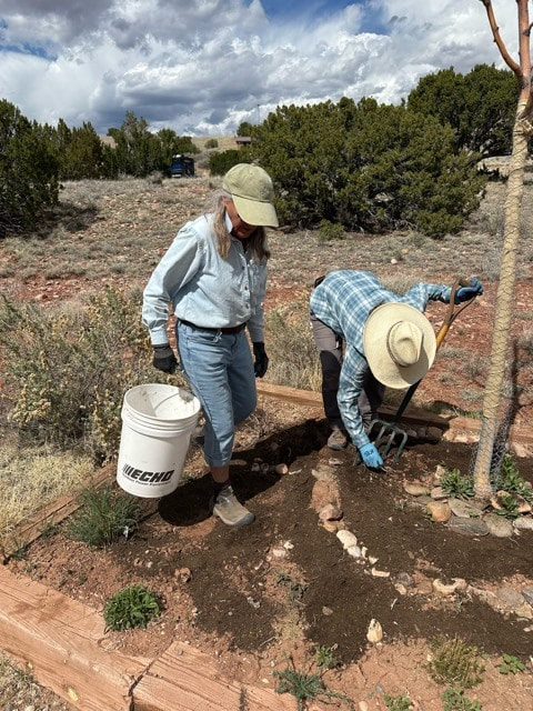 Susan helping with the pollinator garden. Image credit: Army Corps of Engineers. “Many years ago, I was there when the Army Corps of Engineers put up an osprey platform, like they had up at Heron Lake,” Katherine told me. “It's a very tall pole with a platform on the top where ospreys can build their nests. But no osprey has ever used it, I think it's too barren. Maybe they don't know what it's for. But I have often seen a bald eagle perched up there, and some other birds. As I said, there was a bald eagle yesterday when I needed to check the Kestrel box. There was a bald eagle sitting right on top of the osprey nest box. The ospreys come up here for the summer from further south, from the Gulf of Mexico and from below Mexico. They come up here in the summer to breed along the lakes where they can fish, because they are obligate fish eaters. So they breed, have their little chicks, and then they fly again. They can't fish here in the winter because it's frozen,” The eagles stay here for the winter, but where are they in the summer, I asked. “Well, these days bald eagles are almost everywhere,” Katherine told me. “They were an endangered species till 2007 because of DDT and some other impacts. They were seriously endangered, along with peregrine falcons and a number of other birds. But they've recovered marvelously, and now they're all over the place. But they will be here mostly in the winter, and in the summer they will be further north from here, up in Canada and Alaska. But Colorado has nesting pairs, and we have a few nesting pairs here, but not too many.” “At different times in the year we have different numbers of birds. In the winter we have a lot of waterfowl. We'll go down to the river in January and get 26 different species of birds, and maybe eight or nine or more species of waterfowl. In the summer and in the spring we're trading waterfowl for warblers and fly catchers, and the birds that are coming in to nest. Things will really be popping in the next two months.” So over the years that you've been doing this, did you see any kind of fluctuation in the numbers, I asked. “The lake habitat is difficult because the lake level varies so dramatically. A couple of years ago when it was unprecedentedly high, birding was just so much fun because there was so much habitat. But it fluctuates very much. For instance: the grebes build these mats along the shores to nest. When the lake level frequently goes up and down, those mats can't survive, and so we have many fewer grebes. The river fluctuates a great deal too, but the habitat has improved so much in the last 30 years. From being a straight sort of ditch that didn't have willows and didn't have salt brush and other growth it has changed dramatically. A few years ago they put in some structures to help slow the water down in certain places, so it didn't just rush through. It slowed the water down, so more water moved to the side, and you have little wetlands. There are more amphibians down there, and frogs start croaking. I heard them just the other day. And there are a lot more willows now, just a great variety of vegetation. So we're going to get more insects, and we'll get more birds, and it's just just greatly improved. We have river otters there now. They've migrated up and they're actually nesting there.” So we talked about the birds and the water quality, but what about the pollinators, how do you count them, I asked. DO you count them? How many butterflies? How many bees? Katherine explained: “We probably won't get to the species of bees, that's pretty hard, but we can get the family possibly.The important thing is not only what bee do you see, what butterfly do you see, but what plant are they on? Some adult butterflies may be nectar feeders and and visit a lot of different plants, but most butterflies are very specific about where they will lay their eggs, and that will be important. Do we have the plants so that they can multiply?” “The monarchs, famously, lay their eggs on milkweed because that’s what the caterpillars will feed on. Many other butterflies are just as specific. Just mallow plants or aster family plants or mint, because the caterpillars are very specific.” The Army Corps of Engineers has started a pollinator garden in the campground, and the Abiquiú Lake Amigos are helping with that. Katherine clarified: “We do some cross referencing, what butterflies are we likely to see in a grassland kind of area, because that's what it is up there? What native plants can we plant there to attract them? One of the activities this Sunday will be to work on a pollinator garden.” 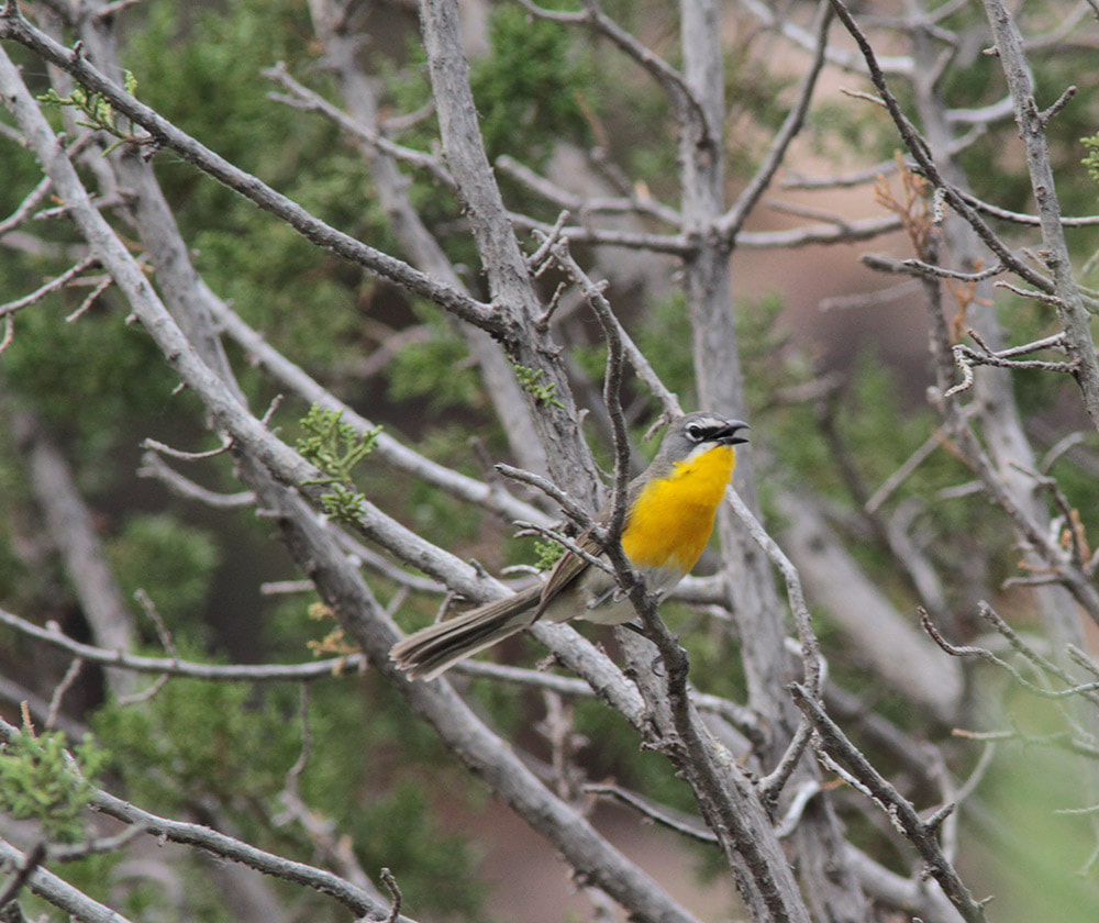 Yellow-breasted chat: migratory species that come here to breed. Image credit: Image credit: Katherine Eagleson. “We want to get really good with these two groups, the Lepidoptera (butterflies, moths) and Hymenoptera (bees, wasps, etc.). Then we can spread out into Coleoptera (beetles), and there's a lot of interest in lightning bugs – fireflies. It's only a couple of weeks that you'll see them up at the lake, and there's one place in particular at the river where I find them and we want to monitor them as well, because they’re also in decline.”
I remember the time when I lived near the river. There were two weeks in June when the fireflies would provide an absolutely magical spectacle at night: like tiny, sparkling stars, they would blink around the bushes close to the water. I’m so grateful that there are people who are concerned about these fascinating insects and try to preserve them. Actually, everything Katherine and her Abiquiú Lake Amigos do is immensely important and may help to stop the further decline of all these creatures which not only deserve to live in peace but also play a significant role in humanity’s food security. Thank you, Katherine, for sharing this meaningful endeavor with the Abiquiú News. A Manly Humanities Man's Guide to Auto Maintenance By Zach Hively The oil warning light came on in my girlfriend’s car the other day, and she wanted me—me!—to Do Something About It. I cannot be the only English major this has happened to.  Sensing the Call to Adventure at this point in our romance, I agreed to take a look. I may have a degree in literature, but I am not otherwise an idiot. I know, deep down, that after I take a look—and if I am a very lucky man—I will get to use some of that gritty orange hand soap that smells so nice. My struggle must not go unchronicled. Not if it can help thousands of other Manly Humanities Men—maybe even dozens of them—to get to use the gritty orange hand soap that smells so nice. Here, in MLA style, is how I Did Something About It: 1. I read the manual. The ENTIRE manual. Because I have this affliction where I cannot see words without reading them. It’s bad. It’s how I, alone among my classmates, finished Paradise Lost. BONUS TIP: Read the manual while seated in the car itself. It provides the same thrill as reading the Narnia books while visiting England.  2. I determined, using my advanced training in critical reading, that the oil warning light indicates a warning in the oil system. Probably a lack of oil pressure. This can be caused by a misalignment in one of the variables in the equation PV=nRT, which I cite at parties to prove that Manly Humanities Men pay attention in physics class too. 3. I translated this knowledge across disciplines. In humanities-speak: Check the oil, you dipstick. 4. After some setbacks in applying theoretical knowledge in a practical setting, I located the car’s engine. 5. I inspected the long flimsy metal testing rod whose name I can’t think of. This thing required graduate-level interpretation. Oil is a viscous substance that clings to long flimsy metal testing rods and leaves room for culturally filtered nuance even upon subsequent readings. But I concluded that the car did, in fact, need oil. 6. I hoofed it to a gas station convenience store to buy some oil. I chose the gas station over the auto parts store because I felt that I, and the ascot I was wearing, would face less unfriendly criticism there. BONUS TIP: Turn down the offer to buy a funnel. Lie that you already have one. A Manly Humanities Man can take only so much abuse before breaking. 7. I made certain my girlfriend was watching from the window when I opened the hood in the driveway. I knew that this time, I could do so on probably the first try. 8. I poured the oil into the place I am fairly confident oil goes. I glugged only a few glugs in other places. Doing so is just fine. I mean, have you SEEN one of these engines before? Oil is EVERYWHERE in there. 9. My girlfriend made it directly to the dealership’s service center and spent $1400. I’m happy to say that nothing critical exploded or caught fire on her way there, leastwise not that she’s mentioned. And THAT is how I earned the privilege of using the gritty orange soap. But I made sure to leave just a bit of dark grease under my fingernails. This will help me intimidate my fellow elbow-patchers by showing them what a real Manly Humanities Man can do. 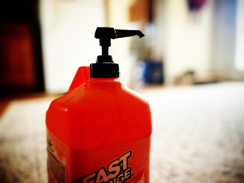 Newly created legislative panel will track federal money coming into New Mexico BY: AUSTIN FISHER - APRIL 29, 2025 12:16 PM Courtesy of Source NM 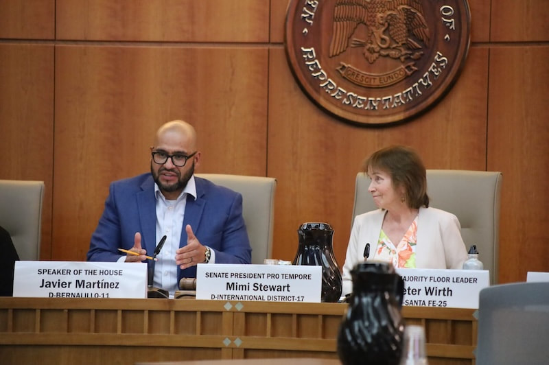 New Mexico House Speaker Javier Martínez and Senate President Pro Tem Mimi Stewart and the rest of the Legislative Council on Monday voted to create the Federal Infrastructure Funds and Stability Interim Committee. (Photo by Austin Fisher / Source NM) New Mexico lawmakers this week rolled out a plan to help prepare for potential hefty reductions in federal funding.
The Legislative Council, the group of state representatives and senators that oversees all lawmaking between New Mexico’s legislative sessions, voted unanimously Monday afternoon at its first meeting following this year’s session to create a new panel called the Federal Infrastructure Funds and Stability Interim Committee. House Speaker Javier Martínez and Senate President Pro Tem Mimi Stewart, both Albuquerque Democrats, told Source NM after the meeting that the committee, in a nutshell, will examine potential federal funding cuts and consider ways to adapt to them if they become real. For example, the committee will look at proposals to cut funding to Head Start, a child care and early education program. This week, U.S. Sens. Martin Heinrich and Ben Ray Luján (D-N.M.) joined 40 other senators in a letter to U.S. Department of Health and Human Services Secretary Robert F. Kennedy, Jr. demanding he immediately unfreeze Head Start funding and reinstate early childhood education workers who have either been laid off or furloughed as result of closures of the preschools, which rely on federal funding. Similarly, the new legislative committee will track funds for Medicaid, the safety-net health insurance program for people with low incomes, Martínez said. Gov. Michelle Lujan Grisham has said previously she might call a special session in the fall, should the state need to address federal shortcomings in programs such as Medicaid. The state also is also party to multi-state lawsuits challenging federal cuts. Its members will also consider the Trump administration’s proposal to abolish the federal Department of Education, Stewart said. Federal funding accounts for 30% of New Mexico’s education budget, she said, including money for special education. Stewart said the committee has no historical precedent in the New Mexico Legislature, noting “this is an ahistorical presidency.” The committee is intended to last for the remainder of the year, but could extend beyond that if needed, she said. Martínez told the Legislative Council the new committee will not duplicate the work being done by the Legislative Finance Committee and other legislative panels but, rather, supplement it with a “proactive approach to deal with any potential reductions in federal funding.” “It will be what I consider to be a very nuts-and-bolts committee, with a tailored, specific focus,” he said. Martínez appointed Rep. Patricia Lundstrom (D-Grants) as the panel’s co-chair from the House of Representatives, and Stewart appointed Sen. William Soules (D-Las Cruces) as the co-chair from the Senate. Lundstrom told Source NM that the new committee will “focus on making sure that no matter what happens at the federal level, New Mexico is ready.” “We will conduct an inventory of existing federal funding streams that our state relies on for infrastructure and local government operations, so that we can begin to proactively prepare for any potential federal funding cuts,” Lundstrom said in a statement. “While decisions in Washington D.C. sow confusion, state lawmakers are stepping up to protect New Mexicans’ access critical services and resource.” An attempt to reach Soules for comment through a spokesperson for the Senate majority was unsuccessful as of publication time. Other members of the new committee include Reps. Susan Herrera (D-Embudo), Raymundo Lara (D-Chamberino), Mark Duncan (R-Kirtland) and Cathrynn Brown (R-Carlsbad); and Sens. George Muñoz (D-Gallup), Linda Trujillo (D-Santa Fe), James Townsend (R-Artesia) and Minority Whip Pat Woods (R-Broadview). The panel is expected to hold an organizational meeting in May, Martínez said. This story was updated following publication to include comments from Rep. Patricia Lundstrom, and corrected to accurately reflect the appointed representatives on the new committee. Source regrets the error. Democrats steer federal hearing toward cuts BY: PATRICK LOHMANN - APRIL 29, 2025 Courtesy of Source NM 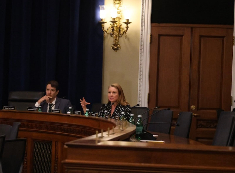 U.S. Rep. Melanie Stansbury (D-NM) asks questions during a Federal Lands Subcommittee meeting Tuesday in Washington. (Photo by Patrick Lohmann / Source NM) WASHINGTON — U.S. Rep. Melanie Stansbury (D-NM) on Tuesday chastised the United States Forest Service for refusing to publicly detail how staffing and other cuts could affect the federal response to wildfires expected soon in New Mexico and elsewhere. Stansbury directed her comments to Forest Service Associate Deputy Chief Ellen Shultzabarger, during the latter’s testimony to the U.S. House Federal Lands Subcommittee, on which Stansbury and fellow New Mexico Democrat Rep. Teresa Leger Fernández serve. Shultzaberger was there speaking in favor of a pair of bills that would allow specific, small pieces of federal forest land to be returned to states and cities, when questions from committee Democrats steered the conversation toward the upcoming wildfire season. “We are continuing to hire to have that goal of 11,300 operational firefighters, and we feel that we’ll be ready for the fire season,” Shultzabarger said. “With all due respect,” Stansbury responded, “I’ve been on the ground for the last couple of months, and Forest Service employees are terrified they’re going to lose their jobs, people are leaving in large numbers and thousands of people have been fired and not rehired. So while I appreciate that that is the company line here in this hearing, and I understand the position that you’re in, it’s just factually untrue. We are not prepared for this fire season.” Dozens of probationary Forest Service employees across New Mexico were fired or resigned since President Donald Trump took office. While judicial orders required the Trump administration to rehire those employees, many who tried to return were simply placed on paid administrative leave. While Forest Service officials have stressed that the mass firings were not aimed at employees whose sole job is dealing with wildfire, some outside estimates suggest three-quarters of those fired had “red cards,” meaning they could be called to help suppress a wildfire if one breaks out. A Colorado Democrat on the committee, Joe Neguse, estimated that 3,000 red card holders were fired. Meanwhile, Forest Service employees are awaiting the results of a “reduction-in-force” restructuring process that could take out another chunk of employees who are not on probationary status. 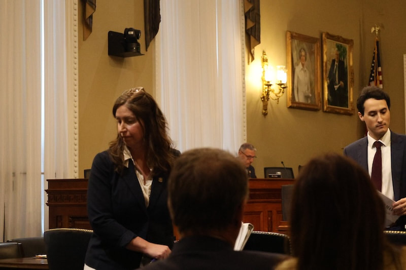 Forest Service Associate Deputy Chief Ellen Shultzabarger, left, stands up after speaking before the Federal Lands Subcommittee on in the House of Representatives on Tuesday. (Photo by Patrick Lohmann / Source NM) Asked about Stansbury’s comments after the meeting, Shultzabarger did not answer, instead deferring to Forest Service spokesperson Kyle Earnest, who did not provide further comment.
Source New Mexico caught up with Stansbury after the hearing in Washington and asked her about the upcoming wildfire season, which forecasts predict could be dire and federal stonewalling on what used to be basic information. The following conversation took place during a short walk from the Capitol and has been edited for clarity and concision. Source: Do you have any sense at all of what we could be looking at with reduction in force in New Mexico forests, in terms of employees lost? MS: We have not received any specific plans. The New Mexico national forests have been heavily impacted by all the mass firings that have happened. The probationary firing that happened at the beginning of the DOGE effort resulted in dozens and dozens, both senior and junior, Forest Service employees, receiving notice that they’ve been fired. A lot of senior Forest Service officials did take the initial deferred departure offer, and we know that there is a RIF restructuring that is coming, but there’s been nothing released publicly, and there’s been nothing released internally. And so when I was home in New Mexico last week, during my town halls, I had Forest Service employees actually come to my town halls and speak to me privately about what’s happening. There’s a complete culture of fear. Nobody has any idea what’s going on. A lot of people are afraid they’re going to lose their jobs. …We’ve been heavily and disproportionately impacted. So we don’t have specific numbers, but we know that the entire workforce is in chaos and struggling right now. Do you know the status of the interagency wildfire dispatch centers, including the one that’s in the Cibola National Forest office, which is on the DOGE termination list? I don’t have any specific details. I mean, one of the things that I think has been really troubling about this entire DOGE exercise is that they claim that they’re doing it with transparency, and yet they refuse to come testify in front of Congress. They don’t even send political appointees to testify. Today, they sent a career staffer rather than a political appointee. And they transmit no information to congressional offices. And, you know, I say this all the time, but this is not normal. In past administrations, regardless of what side of the aisle you are on, it has always been the norm and the practice that if you’re going to make a major change to a district, you notify the congressional offices, you notify the local officials, you notify towns and counties in the state, because all of them are impacted, and there’s zero communication at all between the administration DOG and local authorities, so we have no idea what they’re doing. Do you think we’ll learn more in the president’s budget to be released this week about how those cuts will affect the New Mexico forests? I don’t know. The word on the street is that the budget that will be transmitted this week is what they’re calling a skinny budget. So it will say, you know, [the] Forest Service’s budget is XYZ. It’s cut by XYZ amount and these programs, but I doubt it’ll have the level of detail that you see in a more fully fledged budget, where it describes in detail what their plans are. We ran into New Mexico State Forester Laura McCarthy near the Capitol, who told us she was here ‘lobbying’ but would not say for what bill or issue. Do you know? She’s here? Wow, OK, I’m going to text her. I’m very good friends with Laura. My background is in water resources management, and she and I collaborated a lot on forest and water management in previous lives. So no, I don’t know what she’s up to here. But what I can say in general is that both states and tribes have been heavily impacted by the funding freezes. In fact, just yesterday, Mescalero Apache had a huge forest greenhouse project that had been on hold since the beginning of the Trump administration because they had frozen a [Bureau of Indian Affairs] grant they had received, and it was critical to growing seedlings for reforestation after these big fires, and they just found out yesterday that it had gotten unfrozen. So my guess is that the states and tribes and local authorities are trying to track down grants and federal funding. I think folks are very, very concerned about the upcoming fire season, as I mentioned in the hearing. We have the lowest snow pack in recorded history. And the thing to understand about that is it means that both the river is drying up already, which is unseasonably early, but it also means soil moisture and vegetation moisture is very low, which means basically the entire state’s a tinder box for the fire season. So if and when fires hit us, we’re at a very, very, extremely high risk for a really catastrophic fire season. And as you know, our communities are still reeling and recovering from the last major fires, and we can’t do it without support from the Forest Service, FEMA and these programs that they’re talking about cutting. It’s a bad situation. The Cibola Forest has recently listed a couple of uranium mines near Mount Taylor as priority projects. Do you think those uranium mines could become operational? Well, this administration is absolutely moving forward with stripping away protections for permitting and for national forests. They just issued guidance last week that would reduce all federal permitting to 28 days. In the case of, for example, Mount Taylor — which is not only set aside as national tourist land, but it’s also a sacred site for the pueblos and tribes of New Mexico — you can’t do an environmental and cultural review in 28 days. That’s just going to result in lawsuits. I believe that the administration is going to do everything it can to green-light mining and extractive activities on sensitive lands, and we will fight them every step of the way. Courtesy of the U.S. Department of Agriculture Forest Service The purpose of this Order is to provide for the public's health and safety and to protect National Forest System lands, resources, and facilities during the current period of high fire danger. An emergency exists due to extreme hot and dry weather conditions, as indicated by current fire danger indices. These factors have created an environment in which ignitions from human-caused activities can occur at a much higher rate than normal. Further, wildfires from such ignitions have the propensity to spread extremely quickly, presenting a significant risk to the public safety and substantial obstacles to firefighters in the implementation of wildfire suppression strategies. Alert Start Date: May 4th, 2025 Alert End Date: September 30th, 2025 Order Number: 03-10-00-25-05 Associated Documents Emergency Stage 1 Fire Restrictions Order Forest Order PROHIBITIONS Pursuant to 16 U.S.C § 551 and 36 C.F.R. § 261.50(a), the following are prohibited on all National Forest System lands (NFS) in the Santa Fe National Forest, Sandoval, Los Alamos, Santa Fe, Rio Arriba, Mora and San Miguel counties, State of New Mexico, described below and depicted on the attached map incorporated into this Order as Exhibit A (the "Described Area"): 1. Building, maintaining, or using a fire, including charcoal and briquettes outside a fire structure that is provided by the Forest Service within a designated area as defined in Exhibit B. 36 C.F.R. § 261.52(a). 2. Smoking, except within an enclosed vehicle or building, a developed recreation site, or while stopped in an area at least three (3) feet in diameter that is barren or cleared of all flammable material. 36 C.F.R. § 261.52(d). EXEMPTIONS Pursuant to 36 C.F.R. § 261.50(e), the following persons are exempt from this Order: 1. Persons using a device solely fueled by liquid petroleum or liquified petroleum gas (LPG) fuels that can be turned on and off. Such devices can only be used in an area that is barren or cleared of all overhead and surrounding flammable materials within 3 feet of the device. 2. Persons using a stove fire in a designated area as defined in Exhibit B. 3. Any Federal, State, or Local officer, or member of an organized rescue or firefighting resource in the performance of an official duty. 4. Persons with Forest Service Permit No. FS-7700-48 (Permit for Use of Roads, Trails, or Areas Restricted by Regulation or Order), specifically exempting them from this Order or a written determination by a Forest Service authorized officer that a permit is not required under 36 C.F.R. § 251.50(e)(1) or (2). DESCRIBED AREA All National Forest System lands, roads and trails within the exterior boundaries of the Santa Fe National Forest as depicted on the attached map at Exhibit A. The prohibitions do not apply to any non-National Forest System lands within the Described Area. PURPOSE The purpose of this Order is to provide for the public's health and safety and to protect National Forest System lands, resources, and facilities during the current period of high fire danger. An emergency exists due to extreme hot and dry weather conditions, as indicated by current fire danger indices. These factors have created an environment in which ignitions from human-caused activities can occur at a much higher rate than normal. Further, wildfires from such ignitions have the propensity to spread extremely quickly, presenting a significant risk to the public safety and substantial obstacles to firefighters in the implementation of wildfire suppression strategies. IMPLEMENTATION 1. This order shall be in effect from Sunday May 4, 2025, at 08:00am through September 30, 2025, at midnight, unless rescinded. 2. A map identifying the Described Area is attached and made part of this Order as Exhibit A. For a digital version of this Order and Exhibit A, go to https://www.fs.usda.gov/r03/santafe/alerts 3. A list of "Definitions" is attached and made a part of this Order as Exhibit B. 4. Unless otherwise expressly defined in this Order, the terms used in this Order are defined by the regulations of the Secretary of Agriculture, 36 C.F.R. Chapter 11, Parts 200-299. If there are terms in this Order that are not expressly defined in the Order or 36 C.F.R. Chapter II, Parts 200-299, their meaning shall be determined by their plain language definitions. 5. A violation of the above prohibitions is punishable as a Class B misdemeanor by a fine of not more than $5,000 for individuals and $10,000 for organizations, or by imprisonment for not more than six months, or both. 16 U.S.C. § 551; 18 U.S.C. §§ 3559, 3571, and 3581. 6. Contact the Coyote, Cuba, Jemez, Pecos/Las Vegas and Espanola Ranger Districts located in Coyote, N.M., Cuba, N.M., Jemez Springs, N.M., Pecos, N.M. and Espanola, N.M., telephone numbers (575) 638-5526 (Coyote), (575)-289- 3264 (Cuba), (575) 839-3535 (Jemez), (505) 757-6121 and (505) 425-3534 (Pecos/Las Vegas) and (505) 753-7331 (Espanola), and at the Santa Fe National Forest Supervisor's Office (505) 438-5300 for more information about this Order. 7. This Order supersedes any previous Orders prohibiting the same or similar acts in the same Described Area. EXHIBIT B - EMERGENCY STAGE 1 FIRE RESTRICTIONS DEFINITIONS: DESIGNATED AREA: Developed recreation sites such as campgrounds and picnic areas that are maintained and administered by the Forest Service, shown on the current Forest visitor maps, and are equipped with permanent fire structures. FIRE STRUCTURE: A permanent metal or concrete structure, which is specially designed for the purpose of containing a campfire or cooking fire that has been installed and maintained by the Forest Service or equivalent. STOVE FIRE: A fire built inside a fully enclosed metal stove, grill, or sheep herder type stove, which is outfitted with a chimney that is at least (5) feet in length and is equipped with a spark arrestor consisting of a mesh screen opening of ¼ inch or less. For further definitions or clarification of definitions refer to 36 C.F.R. § 261.2. Contact Name: Claudia Brookshire/Public Affairs Officer Contact Number: 505-438-5320 Contact Email: [email protected] Maps  Click for full-size map showing forest-wide Stage 1 Fire Restrictions
They say you can't go home again, yet apparently you can always go back to the grocery store. By Zach Hively We people sure like to romanticize travel, huh? The possibilities of the open road. The joy of the airport greeting. The certainty that—wherever we go—there will be a McDonald’s with a bathroom. But we over-romanticize the part where we get home. It’s actually the worst part of travel—aside, of course, from leaving home, and from getting where we’re going, and from realizing when we get there that we’re far too tired to enjoy ourselves. The WORST. Oh, we pretend we like coming home. “It feels good to be home, though,” we lie to everyone who asks about our travels. No. We say this just so we don’t rub their faces in our travel the way we used to by showing them slides. Sure, it feels good to be back in our own familiar haunts, where we know precisely where to find fresh toilet paper. And sure, it feels good to use our own pillow we’ve been breaking in for years now instead of some fancy new hotel pillow that makes us wonder how the rest of the world manages to sleep at night. But it does NOT feel good to realize we have to go to the grocery store.  We never budget for this step in coming home. All travel beyond our own county line consumes every last oomph of our available giddyup. It frankly doesn’t much matter if we’re zoned out on a transoceanic flight after an extended stay abroad, or if we simply missed our exit and didn’t realize it for a few hours because this podcast was really engaging, okay? By the laws of the conservation of energy, we have no energy left to conserve once we get within turn-off-the-GPS range of home.
So even if we think we should maybe stop by the store on our way home, we don’t. We are certain we have something to eat for breakfast tomorrow, because we are CAPABLE. We have just done many capable things to prove our capabilityness. Things like exchanging currencies and changing the dashboard clock when we drove across time zones. Yet we know, we know in our world-weary bones, that we will not be capable of handling the self-checkout machines repeating “Please place your … ITEM … in the bag.” Walking in the front door brings on sweet relief—at first. It does feel good to be back. Our home is in order. We are not Bilbo Baggins, presumed dead with all our belongings up for auction. We are not Odysseus, our house overrun with mortal enemies trying to marry our wife. But these stories capture an essential, universal truth about coming home to great upheaval, which we experience when we realize just how hungry we are. We open the fridge to find either:
Oh, and the salt shaker on the counter. The pepper, empty. Romanticize that. At this point, the mere thought of interacting with another human long enough to hand off a bag of dinner is too much to bear. So we scrape together enough willpower to heat water for the hot chocolate. We take it to bed. Our bed, at last. And we fall asleep before it cools enough to enjoy.  By Peter Nagle
Greetings fellow-Abiquiuers and those who are far flung. I think the big topic this month is: Are we going into a Tariff-enduced recession? Some analysts think we’re already in one. Typically we don’t know if we’re officially in a recession until 1-2 quarters later. That’s because economic indicators are backward looking. But we got a stat this morning that says our economy is not growing, in fact it’s contracting for the first time in years. Not a good sign. Here’s the recession timeline according to Dylan Jovine, a good analyst I follow:
It’s probably the worst case scenario but it’s worth noting. We’re a consumer led economy. If consumers reduce spending because they’re concerned about their jobs, that alone could kick us into recession. If consumers go into stores and see empty shelves… I don’t think we’ve ever actually seen how Americans would react to that. It probably would result in hoarding, which would empty shelves even further. Once we’ve exhausted that cycle who knows how people would react? The markets? Typically, depending on the severity of the recession, stocks decline anywhere from 25 - 50%. We’ve already seen a 20% decline in April, half of which has been recouped. But if we’re heading into a recession, that decline is not over. As I said last month, it’s time to be very conservative in your investments in my opinion. I’d be looking at fixed income investments like bonds and deferred annuities to smooth out the ride. Usually in recessions interest rates drop significantly and that’s good for investments like that. I provide financial advice to individuals in our Abiquiu community at no charge as a way of giving back. If you have questions in that area feel free to contact me. I’ll do the best I can to help you sort through the issues. Peter J Nagle Thoughtful Income Advisory Abiquiu, NM 505-423-5378 (mobile) [email protected] |
Submit your ideas for local feature articles
Profiles Gardening Recipes Observations Birding Essays Hiking AuthorsYou! Archives
June 2025
Categories
All
|


 RSS Feed